Monday 9 October 2017

Srebrno Jezero to Veliko Gradište, Beograd and home: Day 21 and 22

Just a few kilometres to walk then a bus to Beograd ready for a flight home the next day.
I woke early to the sound of the men in the room next door getting up, which meant that I was on the road before 7:00 am. Although the map in "Rambling through Serbia" implied a route a little distance from the Danube, the cycle path to Veliko Gradište was too good an opportunity to miss. It took me past where boats were moored, then some expensive looking houses before following the edge of the river. The promenade continued around the town of Veliko Gradiste but I turned off towards where the buses stopped according to the map in my GPS. As I approached there was a bus with a sign saying it went to Beograd loading up. I bought a ticket and climbed on taking the last seat with my rucksack on my lap.
We were immediately off and stopping at various places picking up even more people so the aisle was soon full of standing passengers lacking seats. The driver was having a good laugh with the girl next to me while also answering his mobile phone as we passed places where I had walked along the same road for short distances.
On reaching Belgrade bus station and pushing passed men offering taxis, I had a late breakfast at the Aviator coffee house, visited the Orthodox cathedral, had lunch at the Manufaktura and booked into the Belgrade City Hotel. This left me some free hours and after looking and failing to find a present for my wife decided to visit the National Museum. I discovered this had been closed for renovation for the last 14 years so seeing a man with a yellow umbrella I joined a tour of underground Belgrade. This included a Roman well (that was not Roman and was not a well), a bunker from the cold war, an underground area dug out as a gunpowder store which now had Roman artifacts from the (closed) National museum and a wine cellar where I had a glass or two of wine from the Smederevo area. Not wanting to wander around Belgrade alone at night in a slightly inebriated state I settled for dinner at the hotel restaurant.
Next day I was on the A1 bus to the aerodrome and soon through the formalities at the refreshingly small (and clean and modern) Nikola Tesla airport. After a bit of a scrum with passengers from a delayed Tel Aviv flight it was on the Air Serbia flight to London Heathrow. Unlike recent EasyJet flights there was a free coffee and roll on board, luxury! Now it's time to plan the rest of my walk through Serbia which I hope to cover April next year all going well.

A mere 3.7 kilometres walked today to reach Veliko Gradiste. The GPS of my final section of walk can be found on Wikiloc.com, on ViewRanger.com as johnpon0025 and on Wandermap.net

Early morning walk into Veliko Gradiste

Sunday 8 October 2017

Near Ram to Srebrno Jezero on E4: Day 20

A beautiful start to the day for my last full day of walking on the E4 this year.
There were a number of strange noises in the night. First, a sound like a pack of hounds but I expect they were birds, then there was a lot of crashing around in the undergrowth and this morning the turf by the trees where I was camping was all dug up, wild boar maybe?
A cold start, low mist clung to the ground beneath blue skies softening the lines and obscuring the base of trees, giving everything a grey wash until the sun rose high enough to light up the yellowing leaves of the trees by the river. Ducks ran and flapped into the air as I passed. Gradually Ram castle became visible on a promontory in the river beside a hill. People were fishing from boats in front of it. When I arrived, the castle gates were closed with various signs indicating no one was allowed in and if they were they needed a hard hat. Scaffolding indicated some restoration was in progress. In the village shop where I stopped for a drinking yoghurt (typical at breakfast here) and chocolate a lady who spoke English told me the castle would open at 10:50. Given I still had 26 kilometres to walk this was too late for me so I headed off up the hill.
There was an excellent view from the hill back up the river to a "u" shaped island left by the higher water level created by a dam some distance away. Higher up the path the view was hidden by pine trees so I took a diversion off my planned route to view the river downstream. The river looked like silver in the reflected light from the morning sun, appropriate as I was heading for a place which in English means "Silver Lake". Sunlight was also reflected off flakes of mica in pieces of schist in the track, schist being the type of rock that forms the hill here, which forces the Danube into a narrow valley. Romania is now on its opposite shore. Going off track through the trees to regain my planned route I dropped down to the village of Zatonje briefly joining the Eurovelo cycle route 13 as I did so. This cycle route follows the path of the old Iron curtain, I first met it in Austria.
After the village the route follows the south side of Silver lake formed of an abandoned channel. Initially the lake was hidden by what appeared to be holiday homes, but later the water and the trees on the opposite shore were visible, their leaves turning as autumn approached.
The village of Srebrno Jezero or Silver Lake is a popular spot for tourists. For the first time in Serbia I encountered people enjoying a walk, a Sunday stroll by the lake. Much of the village appears to be under construction, including the Bankers B&B where I am staying. However, I enjoyed a good dinner at a lakeside restaurant carefully watched by two cats...

A GPS trail of my route can be found on wikiloc.com, on ViewRanger.com as johnpon0025 and on Wandermap.net. Today I walked 32.5 kilometres.

Walking beside the Danube at first light

Castle ruins at Ram

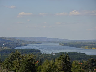
The silvery Danube from the hill by Ram

Saturday 7 October 2017

Požarevac to near Ram on E4: Day 19

Viminacium Roman remains were meant to be the highlight of today but unfortunately the timing of the tours did not work out.
It was raining when I woke up, shopped, looked around a wet Požarevac and started my day's hike in full waterproofs. As I left town I had a quick look at the "Ethno" park where a treaty was signed in 1718 between the Austrians and the Turks although the peace did not last long. Not much to see in the park, everything seemed shut up. As the road turned into a track at the edge of town I saw red and white waymarks indicating a footpath. I have been seeing similar marks since the Belgrade area, but as I do not know where they are going they are of no use, although they do show there are active hikers around.
On reaching the embankment of the Mogila river I headed north (or maybe it was the Mlava river, the maps are contradictory). The going was good until I crossed a road and parallel railway. After that it was good for a while but deteriorated such that the last kilometre before I reached a bridge across the river was really overgrown. It was a battle to get through shrubs growing in the track but surprisingly my waterproofs did not get ripped. Fortunately the bridge I was aiming for was still in existence but missing a number of planks.
On the other side of the river (now definitely the Mlava) the track along the embankment was good and the power station on my route slowly became bigger as I headed North. There were also signs of the strip mining that was supplying the power station with coal. I walked under a conveyor belt and could see signs of restoration work to return the land into a natural state.
From the power station it was up the road to the Viminacium Roman site. This was a major fortification and city for two legions and may have the mausoleum of a Roman emperor. It was after 2 pm when I arrived. The site is spilt between several locations which, I discovered, are visited by a tour. There was a tour at 3:00 pm and it took two hours finishing at 5:00 pm. Sadly this was too late for me as I had a number of kilometres to walk before dark, and with a ticket home booked, no flexibility. I looked at what I was able too which included some excavations but you really needed someone to tell you what you were looking at.
The archaeological site is surrounded by an open cast mine and large draglines could be seen in the distance. Much of the archaeological work was completed ahead of the remains being destroyed by mining.
I returned to the river embankment and walked on past numerous fishermen occupying both sides of the channel. Gradually, as I ventured into a more remote areas, I left the fishermen behind and as the shadows were lengthening, found a place among the trees to pitch my tent for the night.

I walked 34.6 kilometres today including a couple of false trails. A GPS file of my route can be found on wikiloc.com, on ViewRanger.com as johnpon0025 and on Wandermap.net.

Embankment walk

Dragline in action viewed from Viminacium site

Friday 6 October 2017

Radinac to Požarevac on E4: Day 18

The first part of the day was a good walk through hilly country, the second half was along roads across the flat plain of the Veliki Morava river.
It was raining when I went down for breakfast and while it stopped before I set off, the day was overcast with intermittent showers. The centre of the suburb of Radinac seemed to be a haphazard collection of stalls and outlets, fast food joints selling hamburgers and gyros, pekaras and drugstores and a lady selling homemade raki in an assortment of bottles enjoying a new life. Vehicles were parked at odd angles trying avoid the broken drainage covers.
I soon left it behind climbing through houses of various types. One with washing hanging on a balcony with Classical Greek columns caught my eye. Then it was into low trees, vineyards, fields of stubble, orchards and ploughed earth. The leaves on the trees were beginning to change to yellow. My route took me through a few villages, I stopped at one for a coffee and chocolate filled croissant while the owner's young child looked at me like I was an alien (and she was not the first in my travels to do so, and they were not all children).
I came across a cemetery that at first sight was overgrown, but it became apparent that families keep their own section of graves neat while the surrounding areas became hidden by shrubs. As I was looking at red fox crossed between graves. I passed under a motorway and after walking through some hills crossed a bridge over the same motorway at which point I returned to the flat plain of the river Veliki Morava which I had also walked across yesterday.
The next section was on a little used road to the village of Osipaonica. It was not so nice being lined with rubbish dumped on both sides, everything from disposable nappies to builders debris, from old bras to old batteries. There was not much of note in Osipaonica (although some villas, over decorated with columns and balconies, caught my eye).
The final, long section was on a two lane road with low trees each side, again with areas of rubbish. However, there was an interesting iron, truss bridge across the river Veliki Morava which carried both a single lane road and an electrified railway line that went down the middle of the road. There were barriers and a man in attendance who presumably prevented cars coming onto the bridge when a train was coming. It must have been an important bridge once as there were buildings each end with gun slots, evidently designed to defend the bridge from attack.
I am now installed in the Hotel Feniks in Požarevac and have eaten a lonely dinner in their large dining room. Rain is still pattering on the skylight of my room and more rain is forecast for tomorrow.

Today I covered 41.9 kilometres. A GPS track of my route can be found on wikiloc.com, here and here, on ViewRanger.com as johnpon0024 and johnpon0025 and on Wandermap.com here and here.

Typical farm track and a cloudy sky

Road and rail bridge over Veliki Morava

Thursday 5 October 2017

Udovice to Smederevo then Radinac on E4: Day 17

Visited the Smederevo Castle ruins in the morning and hiked a roundabout route through countryside in the afternoon to reach Radinac.
First priority was coffee and breakfast, Hostel Che provided the breakfast while I worked out how to make Turkish coffee, allowing it to boil three times as someone in Hungary once told me. My hosts pointed out the quick way from the Hostel, which overlooks the Danube, back to the village of Udovice avoiding the busy road (which I have put on wikiloc.com to help others). They warned me it was a steep climb, and they were right, but much quicker and safer than along the road.
Udovice had a number of properties whose fences were decorated with white and coloured ribbons, lavender, pink or blue, some had an arch over their gate decorated with ribbons. I had seen these before and wondered if it was because someone in the house was getting married. The village also had some interesting square outhouses with a wheel on the side which I took to be old wells for water.
From Udovice it was a straight route between hedges along the top of the hill to Smederevo. Its later part was waymarked with red circles and a red heart and there were occasional views of the Danube.
Smederevo's principal tourist site is a large castle dating from 1430 at the edge of the Danube, its towers commanding views up and down the river. While it now consists of thick walls and empty towers enclosing a large area of grass it must have looked formidable to the approaching Turkish army. Today it overlooks peaceful fishermen and swans.
I also had a peak inside the Orthodox church of St George off the main square. Paintings covered all the walls beneath a dome with columns each side. However as people were conducting their devotions it seemed wrong to intrude beyond the entrance lobby. I retreated to a nearby café where I watched the pious coming and going from the church, although the old men begging outside did not seem to be doing much trade.
The landscape before Smederevo was hilly but after the town I was walking across the flat flood plain of the Velika Morava. The agriculture had also changed from orchards and vineyards to fields of maize.
The route in the E4 booklet now took me out to the village of Shalinac, initially along a straight road lined with rubbish people had dumped then along a wider road passed drainage channels with fishermen. I skirted Shalinac passing barking dogs, turkeys, chicken and some pretty goats, and proceeded towards the Velika Morava river which I never actually saw behind the trees, instead I turned and followed its embankment. While there were plenty of trees after Shalinac there were also fields where the maize was still being harvested. In places people were picking up cobs of corn missed by the machines and in others the maize stubble was being burnt.
Leaving the embankment I made my way to the village of Lipe and then to my final destination. As I approached Radinac a road sign announced I was entering Smederevo some 5 hours after I left its northern end! I had completed a big "u".
Now I am at the Hotel Zlatnik having enjoyed a large mixed grill among workman who no doubt serviced the local industrial works.

33.7 kilometres walked today including wandering around the castle. A GPS track of my route can be obtained from wikiloc.com, as well as a short route from the E4 to Hotsel Che. My route is also on ViewRanger.com as johnpon0024 and on Wandermap.net.

Ribbons decorating fences and gate, maybe to celebrate a wedding?

Smederevo Castle

Fisherman below castle walls


Wednesday 4 October 2017

Vinča to Udovice on E4: Day 16

It was a day of walking through cherry orchards and vineyards with views of the Danube and the plain of Vojvodina between the trees.
First I had to get safely back to my planned route avoiding the busy road with no pavement. Relying on the Balkan Navitracks map I installed on my GPS I set off along a track signposted to a University of Belgrade site and then via a series of tracks, a footpath and roads I returned to the point at which I turned off for Vinča. A shorter, safer and certainly a more pleasant route than the one I took yesterday.
Apart from the village of Ritopek and the town of Grocka the rest of the day was a walk along tracks and small roads among orchards and vineyards. Although mainly cherry trees there were also apples being picked. Some nice views of the Danube although trees, houses, telegraph poles and electricity lines made it difficult to get a good photo. There was quite a lot of up and down hills contrasting with the flat fields of Vojvodina that I recently walked through and which were visible on the other side of the Danube.
A few issues, the path was muddy in places and near the villages there were houses strung out along the track with barking dogs at many of them. The noise gets wearing after a while. Since Belgrade I also seem to have encountered a lot more dogs wandering about, although fortunately none seemed to have been very aggressive. Whether they had owners or where just living off hand outs and what they could scavenge I do not know. I also had trouble with a fence, 5ft high with barbed wire on the top enclosing a lot of bare earth, not typical of Serbia where most fields are not enclosed. There were two possible routes, the one I picked from Google Earth and the Sultan's trail. I was afraid my route would be blocked at some point by the fence as it would not have been visible to Google's satellites so I took the Sultan's trail route. This was the wrong choice. They evidently recorded their GPS track before the fence was built and I had to retrace my steps and follow my own route.
I reached the village of Udovice as the shadows were lengthening. Elderly tractors were returning to houses in the village with trailers of apples and apple pickers. I saw one lady even sitting "side saddle" on a tractors bonnet. A more relaxed (if less safe) attitude than in the UK (where roll-over protection would be required). A final, rather tedious walk along a busy road has brought me to my lodgings for the night at Hostel Che. I was tired and worried as I was an hour later than the time I had given the owners, but I was warmly welcomed by a lady waiting for me, who offered free raki, coffee and tea. My feeling of well being was completed by a filling meal at the nearby Barik restaurant (the fish soup was very good).

I walked 43 kilometres today, from hotel to hotel. A GPS track of my route can be found at wikiloc.com, which also has the best routes between the E4 and the Hotel Radmilovac and Hostel Che. My route is also on ViewRanger.com as johnpon0024 and on Wandermap.net.

View of the Danube

Tuesday 3 October 2017

Avala to Vinča on E4: Day 15

Highlight of today was the Neolithic site at Vinca which followed a lunch overlooking the Danube.
First I had to retrace my steps for 3.5 kilometres from the Hotel Sucevic Garni to the base of the mountain of Avala. Then I enjoyed sunny weather walking through woodland followed by a village of modern red roofed houses. After walking down to the base of the valley I met my first challenge. There was a new road layout and workmen were busy doing more work in the area which made it difficult to follow my intended route. So I diverted along a new section of road for a kilometre or so to where it crossed the motorway.
How was I to return to my planned route? Fortunately the Navitracks Balkan map I had on my GPS indicated there was a track I could take. It had the wrong starting point but otherwise it led me through meadows of michaelmas daisies to the road I needed, the path only slightly spoiled by sofas and TVs being dumped beside it. After some walking along roads my planned route took me beside a drainage channel. As I discovered, this was not a scenic option, passing various industrial sites and new building, but eventually I reached more pleasant orchards before turning off for Vinča.
A sign directed me to the archaeological site by the River Danube. This was also the location of a few restaurants. I chose one on a boat for lunch which I ate while watching barges going up and down the Danube and cormorants(?) diving for fish. The archaeological site consisted of a few display panels and a small museum which I liked as you can concentrate on all artifacts unlike in a big museum when the number of items on display can overwhelm you. It contained finds from the Neolithic period which were dug up at the riverside site. These included figurines which emphasised female sexual attributes and very small pots used for what I wondered?
Then I retraced my steps and turned up a busy road without pavements to reach the Radmilovac Hotel (my second challenge of the day was to avoid being a traffic accident). The hotel seems upmarket and the restaurant is certainly very good (as is the local red wine). There was even an English speaking Turkish guest to entertain me over coffee.

I walked 26.4 kilometres today, including the walk to the hotel. A GPS track of my route can be found on wikiloc.com, and an alternate route to the hotel from Vinča avoiding the busy road can be found here. My route is also on ViewRanger.com as johnpon0024 and on Wandermap.net.

View of Danube from restaurant at Vinča

Monday 2 October 2017

Beograd to Avala on E4: Day 14

A day spent walking through the parks, woods and suburbs of Belgrade, finishing with a climb up the mountain of Avala.
After breakfast at the Palace hotel, attended by numerous young waiters and waitresses, I returned to the Kalemegdan gardens to start my walk out of Belgrade. "Rambling through Serbia" describes the route as going through the city's parks and woods so this is what I did, walking through Hajd park, Topciderski park and then along a winding road through the woods of Košutnjak, before crossing through suburbs such as Miljakovic to another park, the Memorial park of Jajinci, with a sculpture remembering the 65,000 people killed here in the second world war. I joined the "Sultans trail" near Kumodrazh. I first crossed the long distance Sultans trail near Vienna and for a while followed it down to the village of Beli Potok. In places the track after Kumodrazh was pretty overgrown, but as it was with Michaelmas Daisies rather than stingy nettles it was not too bad, but may be impassable in future years.
While the route I took was generally in the area of the E4 as described in the booklet I am sure there are better routes involving less walking along roads. I saw plenty of footpaths in the woods and also red and white waymarks at various points but as I did not know where they went I stuck to roads or tracks that were on the map or which I had spotted from Google Earth. Anyone willing to contribute a better route add a comment below and put a GPS track on Wikiloc.com, Viewranger or similar.
After the plains of Vojvodina the hills of southern Belgrade were a contrast. The final climb to Avala was particularly steep (I was following blue and white triangle waymarks at that point). I was prevented from reaching the memorial to the unknown soldier at the very top by policemen (there were a lot of them). It seems the President of Greece was visiting and had not been told to expect me. So it was off to the nearby TV tower, bombed by NATO in 1999 and subsequently rebuilt to look a bit like a rocket at its base. I bought the "viewing station plus beer in the tower's cafe" ticket which I would recommend. The beer tastes better after sweating up the mountain and sitting in the bar high up in the tower is a warmer and generally more pleasant way to view the scenery compared with the lookout platform. It was pretty hazy so the scenery was rather indistinct but I could see that I had walked a good distance today.
Then it was back down the mountain (foĺlowing red and white waymarks) and some retracing of steps to reach the Hotel Sucevic Garni a few kilometres away, which was the nearest accommodation I could get. It does have a nice "Etno" restaurant where the helpful waiter recommended what to eat and I agreed. Now I am stuffed!

Including retracing my steps to the hotel I walked 38.7 kilometres today. My route can be found on Wikiloc.com, on ViewRanger.com as johnpon0024 and on Wandermap.net. In loading my route into Wikiloc.com I noticed a number of trails published for Košutnjak and Avala that I missed when first planning my trip. If you are planning to follow my route, you may well want a look at these to see if you can improve on the path I took.

Belgrade Park

Avala mountain with TV Tower


Sunday 1 October 2017

Walking Vojvodina on E4 long distance European walk

The question arises as to why you should walk across the flat, agricultural plain of Vojvodina for two weeks?
First answer is to get to Greece as part of a walk across Europe. Indeed this is why many people have crossed Vojvodina over the years although usually in cars (although I suppose the Turks used horses).
Are there other reasons?
A second reason is the adventure of going to a country few tourists visit and to a part of the country where those few tourists rarely enter. Serbia is different with its funny Cyrillic letters and a recent history that does not encourage holidays. The E4 gives a route into this adventure.
A third reason is cultural. The area is a mix of Hungarian, Romanian and Serbian influences. Towns like Senta show the influence of Hungarian Art Nouveau and different architectural styles are present wherever you look.
The final reason is the countryside, the rythm of the agricultural activity, the ageless flocks of sheep with their shepherds or herds of cows with their cowherds. the crops, the canals and their fisherman escaping to some solitude, the great rivers flowing South.


Pančevo to Beograd on E4: Day 13

Achieved a milestone today reaching Beograd or Belgrade as we call it. The walk was not however straight forward.
"Rambling through Serbia" clearly shows that after leaving Pančevo and crossing the Tamis the route drops down and continues close to the Danube for 3 kilometres or so. I assumed that the authors did not intend a walk along the busy E70 dual carriageway so I picked a route visible on Google Earth through the floodplain woodland just to the North. I could not see exactly where it came out but trees hide where tracks are located from passing satellites. It turned out that although there were plenty of tracks in the forest, an exit was hard to find. I came within 200 metres of a nearby abandoned road at one point but after yesterday's abortive attempt to force my way through undergrowth I did not want a repeat failure. After following several false trails I eventually came out of the woods onto the Pančevo road very close to where I left it. Some of the tracks I followed were waymarked with red and white  (not red and yellow used for the E4) but as I did not know where the red and white waymarks were going to or coming from this was not helpful. I spent 2.5 hours walking 10 kilometres through the trees without getting any closer to Beograd. While it was a pleasant walk for a little while, I would advise anyone in future to stick to the route marked for cyclists  (the Euro 6 cycle route) which I then did until I crossed the bridge into Belgrade. If anyone knows the correct path to take please comment below. In fact the cycle route along the embankment to the Danube bridge afforded good views of the woodland to the south. In places there were man made ponds that swans and various other birds were enjoying, framed by trees just beginning to turn yellow. After a bit of a detour to reach the right (i.e. westerly side) of the bridge, I crossed the Danube for the fourth (and last) time on my trip across Europe. The footpath on the lengthy bridge was not so wide considering the fast cars and buses on one side and the railings separating me from the Danube (and then various gravel works) on the other.
After a long drag along a busy, dusty street I reached the Stari Grad or Old Town, which has a lovely pedestrianised area. I stopped at the Tourist Information office to try and book some accommodation for the following days but of the three places we tried, one was being renovated, the phone was dead at another and the third did not answer. I am now at the Palace Hotel (booked online yesterday with Booking.com) having earlier visited the Kalemegdan gardens to view the sunset. This is a popular activity and the promenades overlooking the Sava river were crowded with people doing the same thing, many getting a "selfie" with the setting sun in the background. The old castle walls truly looked beautiful with the warm light of the setting sun, the scattered floodlights, the trees and hedges.
Belgrade's Stari Grad was shock after the quiet provincial towns and villages I had been walking through. Full of people, the many pavement cafés busy (it is Sunday), buskers singing or playing (some better than others) and artists selling their paintings on the pedestrianised streets. For the first time in Serbia I heard English and German being spoken by tourists visiting the city. Until Belgrade I do not recall encountering a single one.

For a GPS file of my route click on the link here and here to wikiloc.com, it can also be found on ViewRanger.com as route johnpon0023 and johnpon0024, and on Wandermap.net here and here. Today I walked some 30 kilometres.

Deciduous trees in flood plain forest beside Danube

Kalemegdan fortress in the evening