Saturday 31 March 2018

Majdanpek to Donji Milanovac on E4 Day 34

Today was a long day which ended back at the Danube at Donji Milanovac.
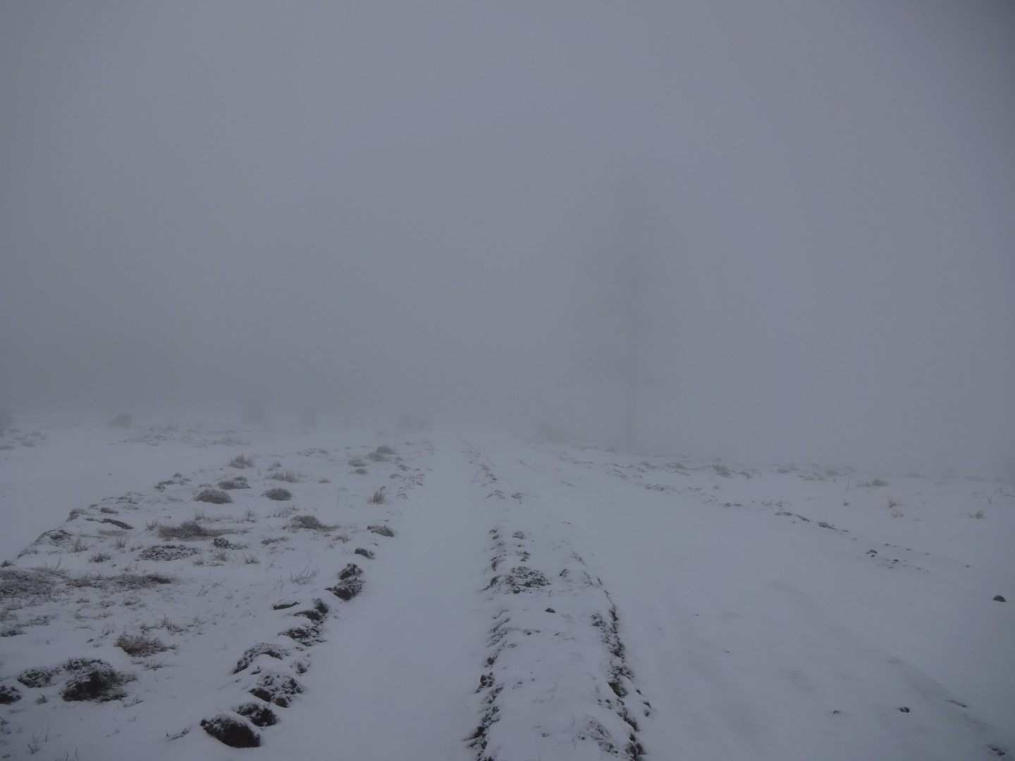
I left town on a road leading to a lake and caves. The caves were closed but no doubt will be open to tourists later in the year. Just before them was another example of a river coming out of a cave. I followed footprints up a path which climbed a dry, limestone valley. It was not to stay dry, the next curiosity was a brook, swollen by meltwater disappearing into a cave. As I progressed the rocks changed from limestone, through which water can create caves to flow underground, to a metamorphic rock, impermeable to water. The net result was that the valley became very wet and muddy.
I continued following my route which at a certain point changed heading from north to east. At this point my difficulties began. The route I picked from Google Earth seemed to follow a track overgrown with beech sapplings or no track at all. In addition it was necessary to cross what would normally be a little stream but the melting snow had made it a deep and wide channel. Inevitably I gained wet feet. I pushed on through the beech trees, upright and fallen, eventually reaching a better used track which led to a road which marked my half way point. If you are heading this way then you may want to research an alternative route from the caves to the road.
From this road the "Rambling through Serbia" booklet has a diversion to Lepenski vir, where there is a famous Neolithic site and museum, however at 15.5 kilometres to get there and 15.5 kilometres to come back on the same road, it was not a short diversion and I gave it a miss.
Instead I turned off the road onto a ridge path going east, periodically blocked by fallen trees and made difficult by snow left in sunken parts of the trail. Passing the summit of Liskovac I diverted to reach the top, but it was not worth the effort as trees blocked any views. The final summit of the ridge path (Bukova Glava) was more rewarding. It was marked by a rock with a star on top and distant snow topped mountains lined the horizon to the east and south.
I decided to try and reach Donji Milanovac that evening so stepped up the pace for the last 10 kilometres or so. Mud, waterlogged tracks and the remains of old snow drifts held me up, but I managed to reach Hotel Lepinski Var before 7:00 pm. The hotel looked closed but there was a man behind reception in the darkened lobby who gave me a room with a view of the Danube.
I am now in the town having enjoyed grilled trout. Makes a change from pork.

35.1 kilometres walked today, with over a 1000 metres of ascent. A gpx file of my route can be found on Wikiloc.com, and WanderMap.net. The route can also be downloaded from Viewranger.com as johnpon0027.

River disappearing into a cave

Traditional haystack
Summit of Bukova Glava

Friday 30 March 2018

Kupinova Glava to Majdanpek on E4 Day 33

A ridge walk with views, downhill through trees, along a road, through an open cast copper mine and into the town of Majdanpek. My day in brief.
The wind died down overnight and my tent was undisturbed and dry for the first time this trip. I watched the dawn break orange over the mountains that I subsequently hoped to cross, in particular the jagged ridge of Veliki Krs. My route took me up and down along a rounded ridge. Well forested to the north, there were frequent views to the south. Before dropping down through trees into the valley I climbed up to the summit of Breza. It was worth battling through trees and bushes to reach the top of this rocky peak for the sight of 360 degrees of snowy mountains, especially on a fine day like today. Note that the summit can only be approached from the south.
Coming down the north side of the ridge through the woods I unexpectedly came across some surveyors! Ruts in the track contained streams of melt water, and the muddy brooks and river were bursting from their usual confines. Consequently I was thankful to reach the road with my last 10 kilometres or so on tarmac, while my feet did not get dry they at least did not get any wetter. The road went up a wooded valley under a railway viaduct and through the rural village of Debeli Lug. Then the character of the area changed with a modern factory area mixed with remains of older industry. Finally a few kilometres before Majdanpek I followed the road through a tunnel into a massive hole opened up to extract copper, with lessor amounts of gold and silver. I could see huge dumper trucks going up and down to collect the ore. I was seeing for free what I had paid money to see in Kalgoorlie in Australia.
The town, consisting largely of blocks of flats, was a complete contrast to earlier rural towns on my trip. It starts at the point the pit ends and my hotel, the Golden Inn was not far beyond it. A hotel in which I was given a large suite with deep pile carpets, fluffy white towels, large TVs...you get the idea, a lot more luxurious than a miniature tent on a hilltop, and the receptionist spoke English. A bit lonely in the large restaurant area though.

23.2 kilometres walked today, mostly downhill. A gpx file of my route can be found on Wikiloc.com, and WanderMap.net. The route can also be downloaded from Viewranger.com as johnpon0027.

Dawn over the mountains by my campsite

Veliki Krs , I think, in the distance, a later part of the route

Tunnel you go through to enter the large open cast mine on the public road

Majdanpek copper mine

Thursday 29 March 2018

Žagubica to Kupinova Glava on E4 Day 32

A sunny walk across flat farmland in the morning and a long climb up the mountain of Kupinova Glava in the afternoon in an area of friendly people.
My rest day yesterday passed all too quickly but left me in high spirits. Everything except my boots were dry and they were merely damp. I left town following tarmac roads mainly, across the large flat valley that the town of Žagubica lies at the edge of. I passed the Tryska Crkva monastery church, locked but clearly old. As I walked through the villages of Milatovac and Seliste the land became more hilly. The latter had another National Monument - I was unclear what it was.
People were friendly, smiling when I said Dober Dan (good day) to them, in one case I almost had a conversation. I think he thought it would be easier to take a taxi to Majdanpek, the next town I am going to. It is a very rural farming area with chickens running on the road and the typical hayricks of the area where the hay is stacked around a central pole. People were out in the sun trimming hedges, pruning and pollarding. The women were soberly dressed wearing thick black stockings,  grey or black skirts, jumper, headscarves, often a "gilet" and sometimes an apron, all in sombre colours. 
After Seliste the trail climbed steadily and the snow, absent now on the valley floor began to appear in patches. Above 700 metres it was patches of grass rather than patches of snow and above 800 metres it was just snow except in exposed spots were the wind had blown it off into snow drifts across my path. Soon my boots and socks were soaking wet again after pushing through deep but very wet snow snow drifts as wells as stepping into puddles hidden beneath the snow.
Below about 700 metres there were plenty of hill farms and pasture, higher up it was more tree covered. On my way up I was asked by a farmer and his wife if I would like a coffee. It sounded attractive so I joined them in their little hillside house, warmed by a wood burning range. He made Turkish style coffee while his wife was preparing what looked like nettle soup. As we had no common language conversation was difficult however he showed me photos on his phone of his animals (lambs, sheep, hens,  dogs, cats etc.), his wife and mother, also a huge wild boar he had shot. Despite me almost knocking down his porch with my rucksack he kindly gave me a bottle of lemonade to take. Much appreciated as it was thirsty work climbing in the sun. I left him a postcard of my home town. Probably not a fair exchange!
There was a superb view from Kupinova Glava's summit of snow covered mountains and what looked like the open cast mine of Majdanpek, my stop for tomorrow. Now I am camped a bit further along the ridge in a somewhat exposed spot but on a rare patch of grass free of snow. Just a bit worried as the wind is blowing up. When I attended a hill walking course at the Plas y Brenin centre in Snowdonia the instructor was not too impressed with my lightweight tent (a Tera Nova Laser Competition) and it's ability in the wind.....

26.4 kilometres walked today with an 860 metre ascent. A gpx file of my route can be found on Wikiloc.com, and WanderMap.net. The route can also be downloaded from Viewranger.com as johnpon0027.

Tryska Crkva monastery church

Summit of Kupinova Glava

Wednesday 28 March 2018

Zagubica Day 31

It turns out that Zagubica does have accomodation at the Vrelo Mlave, another national monument where a river, in this case the Mlava, just comes out of the ground, although in this case there is no cave to see.
It was a short walk from my campsite to Zagubica passed the usual cemetery on the outskirts of town. Some of the gravestones have wonderful pictures of the dead etched in them, one of the husband and wife sitting at a table having a drink caught my eye.
I arrived at the restaurant by the river source in time for a breakfast of omelette and bread so fresh it was hot to handle. Not as early as I thought as unbeknown to me the clocks had gone forward the previous weekend. Seeing a sign saying Sobe (rooms) I asked for one, having decided to call this a rest day after the exertions of the past few days and a strong desire for dry socks. After some  interpreting by the cook I am now safely in my room. I have washed the clothes I have been living and sleeping in for the last 4 days and hopefully they will be dry by tomorrow. To absolutely make my day the sun has been shining.
The town has a nice pedestrianised street and the other streets have potholes. I bought some provisions for tomorrow and had a coffee, yoghurt and strudel confection for lunch. More my idea of a long distance walk!

My thoughts turned to what I had right and what I had wrong for my walk through snow for the last few days.
On the plus side I had adequate clothing, I was hot pushing through the snow (apart from my wet feet) but cooled down quickly on stopping. 4 layers of clothing including a synthetic "down" jacket then kept me warm, I also had liner gloves and winter gloves plus a spare set of gloves. Merino wool long johns, trousers and waterproof, over trousers kept my legs in comfort. My Mountain Hardware sleeping bag was rated for -6 C and again synthetic so it kept my feet warm even though wet, accumulated condensation and general wetness in the tent was a big issue, and that was with no socks on. On the downside it was rather bulky. A Thermarest airbed designed only to support my upper body, packed small but kept me off the cold snow beneath my tent's groundsheet. I also had adequate supplies of water (up to 4 litres) but was not very good at drinking it as it was ice cold and sometimes starting to form ice. My pee stops were infrequent but very yellow as a result.
Biggest downside were my boots which leaked although they had only done 500 miles, disappointing as previous Brasher boots of the same type had managed 1500 miles, maybe not such good boots now Berghaus has bought the company out. Even if they had been leak proof snow was getting under my gaiters and into the top of my boots as well. Heavy mountain boots with gaiters more suitable for snow would have been a better bet, but they would have been heavy and not ideal for the several hundred kilometres I still had to walk. Walking with a group would have helped both in case of problems and to share the task of breaking trail. Weather forecasts (including mountain forecasts) were too optimistic in this period.
However all life is about learning. On the plus side it takes the hardship of days of ice cold, wet feet to really gain intense pleasure from a dry pair of socks...

A mere 3.7 kilometres walk today from last night's campsite to my gorgeous breakfast. A gpx file of my route can be found on Wikiloc.com, and WanderMap.net. The route can also be downloaded from Viewranger.com as johnpon0027.

Tuesday 27 March 2018

Beljanica on E4 Day 30

Another hard day pushing through snow.
I woke to find myself in a wet mist with limited visibility which turned to snow as I packed up. Trudging through snow and snow drifts, slipping into ruts made by forestry vehicles sapped my energy and was clearly straining my body despite frequent rests to slow my breathing and limit the stress on my knees. Progress was slow. I thought of turning back as the safest option, thinking of someone who recently had a heart attack.
Then I came across a road I had long been expecting from maps and, joy to behold, the snow had been cleared (or a least compacted) by a bulldozer a day or so ago. There were even car tracks!
Walking was comparatively easy now walking on the tracks of the bulldozer. This was my salvation, and as I reached the highest point on the road I was moved to start thanking God. Then I saw the abandoned bulldozer,  the cleared road ended shortly after. The tyre tracks must have been the car taking the bulldozer driver home. To continue I had to break a trail through snow about 50 cm deep and thicker in drifts, hard to get through. I contemplated following the bulldozer tracks in the other direction, taking me south, but that was completely the wrong direction. Reasoning that as the road now dropped in height from the highest point of 1260 metres to 800 metres the snow should become less thick and easier to walk through, I decided to push on and so it proved. By 800 metres the snow was a more reasonable 6 cm in thickness, wet and slushy. My feet were not enjoying the constant soaking and there were areas of snow drifts making for particularly hard going. I had intended to make a diversion to the highest summit of Beljanica at 1320 metres, but the snow meant the extra 3.5 kilometres was not a viable option and the limited visibility meant there would be nothing to see.
Visibility improved as I descended and there was even a period when the sun came out, making the mountain landscape look a lot more pleasant. Rocky peaks and deep valleys mainly wooded with firs and deciduous trees, a moss covered waterfall, and some mountain farms on flatter sections, although none seemed inhabited, or so I thought. Towards the end of my walk I heard voices, the first since yesterday afternoon, then joined car tracks and eventually a 4 wheel drive passed and offered a lift. Tempting, but I had almost walked across the Beljanica range in difficult conditions and it seemed a shame not to complete this possibly foolhardy achievement. Instead I camped in some trees by the roadside. I could have got a lift to Zagubica, or walked there arriving late, but I had not been able to confirm that any accommodation existed in the town or whether transport to somewhere else was available. If there was not I could be stuck in a town with nowhere suitable to camp.
So another night on the snow under canvas, thinking how tents designed for snowy conditions probably had insulated floors, both for comfort and so that water did not immediately condense on them.

28.1 kilometres with a 780 metre ascent, it felt like longer! A gpx file of my route can be found on Wikiloc.com, and WanderMap.net. The route can also be downloaded from Viewranger.com as johnpon0027.


Low visibility in a more windswept area of the rutted track

Section of road that had been bulldozed


Monday 26 March 2018

Krupajsko Springhead on E4 Day 29

Unlike yesterday my boots were not frozen due to the thaw at lower elevations, just very wet.
Most of the day was following a route to Krupajsko Springhead sent to me by Planinarsko Drustvo Gornjak (Gornjak mountain association) for which they have my thanks. A picturesque walk with several vista's of the surrounding countryside. I particularly liked a road across some high ground passing several farms, because of the great views but also as it was clear of snow so easy walking. One downside was that the streams were swollen by melt water and I had to ford one that you could normally jump across. No great loss as my boots were already saturated by water due to the melting snow which was taking on a wet, coarsely crystalline form as it thawed and pushed up underneath my gaiters as I pressed into it. On a second brook, a bridge formed by a single log had been provided with a rudely formed handrail for balance. I am glad the handrail did not collapse as I eased my way across!
At Krupajsko Springhead  (a national monument) a large volume of water came straight out of a limestone cave. To see it you walk along a narrow concrete "wall" which encloses large numbers of fish swimming against the current  (presumably being farmed). After the usual language impass I gained a cup of coffee at the nearby café (?), the lady serving did not understand me but at least she made an effort and another visitor helped.
For the last few hours of my hike, I climbed into the Beljanica mountains, with increasing amounts of snow on the ground. I am now camped on snow. If it thaws too quickly overnight the tent will collapse as the pegs don't reach the soil!

23.2 kilometres today with 1280 metres of ascent. A gpx file of my route can be found on Wikiloc.com, and WanderMap.net. The route can also be downloaded from Viewranger.com as johnpon0027.

Typical farms

Krupajsko springhead

Sunday 25 March 2018

Štrubej to Gornjak on E4 Day 28

Another tiring day in the snowy mountains with a disappointing end.
It was an unpleasant start to the day as my boots were so frozen I had difficulty getting them on. My socks were wet but warm as I kept them in my sleeping bag overnight. My boots gradually thawed as I climbed steeply through trees to the top of Vrh Štrubej. I did not stay long at the top, I was worried about weather, it felt a bit like being in the "death zone" on Everest but it was only 940 m high! I followed various trail markings down and then south. The snow slowed me down especially where drifting had made it deep. The track was very variable, deeply rutted in places beneath the snow as a result of logging operations which made me slither about. At only 2.1 km/hr I was achieving almost half my normal pace. I had planned to cross Vratna mountain but bypassed it as it looked steep and rocky and I was just too tired.
On the approach to the mountain of Veliki Vulcan I came across my first footprints of the day, left by a group of people! I felt sad when my route turned off theirs. My route took me up the mountain of Mali Vulcan. The last section was very steep but well waymarked, although fallen trees made the climb more difficult. Although within 20 metres of the top of Mali Vulcan I did not go to the summit as my chosen route headed down before the then. Probably a mistake as it was difficult to find my planned path down and I knew there were other trails from the top. Due to snow obscuring the track I lost the path for much of the time, any trail markings were very faint. I was heavily dependant on my GPS which was not convenient when you need both hands to balance and in one I had my trekking pole which stopped me falling a number of times. Somewhere the basket on the bottom of my pole sheared off. Maybe no great loss as it tended to grow a ball of ice and snow. I was floundering in the snow on the steep and wooded slope, tripping and slipping on hidden branches. It would have been a poor path even in good weather, overgrown in places. Eventually I joined another path coming down from the summit with the footprints of walkers. They must have come down from the summit earlier by a better route. I easily followed their tracks down to the road. It was then a quick and easy walk through a narrow valley surrounded by mountains to Gornjak monastery passing another abandoned monastery cut into the cliffs.
As daylight waned I reached Gornjak and admit I was hoping for a welcome like I had received at Tumane, and maybe even a bed and something to eat. Unfortunately the lone lady at the monastery did not understand me and I did not understand her, my fault for not speaking the language of the country at all but it would have been nice to see the church (I think I was there a little before closing time at 6:00 pm). Instead I was directed to the exit. There appeared to be some accommodation opposite but it was all closed up and deserted except for the inevitable dog.
So I walked up the valley and camped by a spring where there was a picnic table on a little bit of higher ground. Camping close to the river I thought unwise as the snow was melting and the river looked close to flooding. It would have been a pleasant picnic spot in nice weather. There was a deserted tunnel and an old building nearby, created by the Germans in the second world war. As I went to sleep big drops of water from melting snow were landing on my tent.

A 27.7 kilometre walk today with just under a 1000 metres of climbing. A gpx file of my route can be found on Wikiloc.com, and WanderMap.net. The route can also be downloaded from Viewranger.com as johnpon0027.

On the summit of Vrh Stubej

Snow drifts making the going difficult, Vratna mountain ahead

Snowy views

Road to Gornjak monastery, note old monastery in cliff ahead

Saturday 24 March 2018

Kučevo to Vrh Štubej on E4, Day 27

After a long tiring day yesterday I decided on a shorter day, checking out at 10:00 am and stopping to camp at 4:30 pm on the side of the mountain of Vrh Strubej.
I might have been tempted to stay a second night at Hotel Rudnik to rest, but as I had trouble shutting my bedroom door without the help of the waiter I decided against it. Before setting off I made some purchases of food at Kučevo. The town seemed to have a couple of markets selling vegetables, clothes etc.. Some of the stalls were just tables with people's own produce for sale, such as dried chillies, honey and onions.
The first part of my walk was an easy stroll along a road, then I headed off following red and white footpath markers to the village of Ravnište through trees and then passed farms, going up and down hills. At each little settlement dogs barked at me making it clear they felt I was NOT welcome. However the two people I passed were more friendly, one (I think) advising I should have a hat on in the wintery weather.
A little way after the village were the Ravništarka Pećina, pećina meaning caves. They were closed but looked like a nice spot in the summer with a café and chalets. At the caves I saw a sign saying Štubej 3 hours. Although not my intended route it was a footpath marked on my Garmin GPS map so I followed its red and white trail markings.
It took rather longer than 3 hours due to snow drifts, and as I climbed, breaking trail through the snow became increasingly difficult. It was undeniably pretty with snow coated trees and only a few animal tracks marking the unblemished snow.
I camped on some flat ground among trees at 780 m, leaving the 940 m summit of Štubej for tomorrow, taking care to keep my water bottles off the floor of the tent, on my coat, to stop them freezing.

Today I only covered 18.7 kilometres but that included over 900 metres of accumulated ascent through snow. A gpx file of my route can be found on Wikiloc.com, and WanderMap.net. The route can also be downloaded from Viewranger.com as johnpon0027.

The track up Mount Stubej

Friday 23 March 2018

Tumane to Kučevo on E4 Day 26

Today was hard work pushing through the snow up a number of ascents but covering a lot of ground.
I woke at 11:30 pm last night and it was snowing. After tightening the guy ropes I soon fell asleep again, thankfully of my -6 deg C rated sleeping bag and torso length airbed. I woke again at 5:30 am. Snow coated much of the tent, making curious sliding sounds every so often as it gathered around the base. After decamping and admiring the various animals (turkeys, ostriches, a donkey etc.) kept by the monastery in the pens next to where I camped, I was kindly offered coffee while the animals were fed and then started on my way.
The first sight, a little way up the wooded valley, was a cave in the limestone tufa where a saint once lived. After that the path became steeper as it climbed a ridge between two valleys and my going  slowed to short sections followed by rests. On reaching the head of the valleys I spotted my path and headed down it. Unfortunately it became very overgrown and I had trouble even finding the trail in the snow in places. Eventually I reached the more defined track down the other side of the mountains into the village of Rakova Bara. 
As I walked through the village, in the snow I mistook someone's back yard for the road. I then had trouble convincing the owner of the yard (and then his wife, daughter and a passing friend of his) that I actually knew where I was going. After shaking off my help, who were encouraging me to take a road route to Kučevo, I found my planned track out of town into the surrounding hills.
A long climb followed as I pushed through snow, thicker the higher I reached, to the next summit (Rakobarski Vis). Looking back I could see some great views of snow covered mountains but I was struggling with breaking trail through deep snow in areas where it had accumulated. Eventually I reached the summit. There was an aerial and a building associated with it and although the building was closed the steps made a convenient place to sit and eat some lunch (a roll, cheese and oranges, I had already dealt with the chocolate) while thinking what a lot of snowy mountains I could see, a number of which I would have to climb over.
After a ridge walk across open land, trying to keep to where grass stalks indicated the snow was not too deep, the route took me downhill into the village of Duboka, heralded by a cacophony of dog barks. Apparently a Vlach settlement according to my notes, it was much more spread out than Rakova Bara.
Inevitably there was another climb out of Duboka, and time was moving on. I rang the hotel in Kučevo and as they said they could accommodate me I pressed on. After a lengthy, up and down trail, the snow covered roofs of the houses of Kučevo were a welcome sight. Just as I entered the edge of town the street lights came on, looking like brilliant jewels in the valley below among the winter gloom.
Hotel Rudnik, where I am staying, had some bad reviews online, and so far they appear justified, although the waiter and general troubleshooter is very helpful.

33.7 kilometres today with a lot of climbing (1300 metres according to my GPS). A gpx file of my route can be found on Wikiloc.com, and WanderMap.net. The route can also be downloaded from Viewranger.com as johnpon0027.

My tent in the morning after a snowy night

Country I was walking through

Thursday 22 March 2018

Golubac to Tumane on E4 Day 25

Today I headed south into the Homolje mountains as part of a big "U" shape in the route that will bring me back to the Danube some 60 km downstream.
Most of today involved climbing up, along and down mountains in the snow, often among leafless trees, but first I followed the road to the fortress of Golubac. The road was right on the edge of the Danube below a steep slope, with sections of overhanging rock. Pretty scenic although it would have benefited from a pedestrian walkway.
The fortress itself was closed for restoration but there was an exhibition, the remains of an ancient hammam (an arabic bathhouse) and a café. The helpful barista told me of the 360 degree view on the top of the first mountain I would be climbing, and recommended the locally made cookies (they were nice and soft).
This first steep climb up the side of the Danube valley provided several views of the river and the fortress from progressively higher levels. I took a detour to the summit to see the promised panorama (good but the aerial there got in the way a bit). Continuing easterly along a ridge I passed various buildings, mostly in a state of advanced decay but one in better condition that was inhabited,  footprints in the snow showing somebody was living there. These were the only footprints I saw on my walk today although there were plenty of animal tracks. There was a section where I had marked a route out onto a ridge based on a trail on Wikiloc.com. However the hoped for views were obscured by snow starting to fall and general mistiness, so after some lunch I returned to the main route and continued on my way to the Tumane monastery through progressively deeper snow. One of the problems with snow is that you cannot see what is beneath it, so I stumbled several times on hidden branches and ruts, and once put my foot into a deep puddle wetting my socks. At one point I fell into a deep snow drift and struggled to get out.
As I approached my final summit, Golo Brdo,  a 4 wheel drive came along the track "beeping" his horn at me, I am not sure why, he did not stop. While enjoying the achievement of reaching this final high point, I noticed the water in my bottle was starting to freeze, making me wonder if it would freeze completely and split my water bottle. Time to loose height and find somewhere to sleep tonight.
After dropping down steeply into the valley following car tracks, I hit the road which took me to the Tumane monastery. On reaching the monastery I was called over to a building, flooded with warm light in the gathering dusk. I was offered some of the local plum brandy by a friendly bunch, which certainly provided inner warmth while the stove in the room toasted my outside. One of the men, called Dragon (?) showed me the church and its relics, an icon brought from Russia by monks fleeing communism, and the remains of two saints. The monastery was founded back in the 13th century but church had been rebuilt many times and the frescos repainted. They showed scenes from the bible and paintings of saints, all looking solemn.
They kindly gave me dinner, vegetable stew, pickled vegetables and bread; no meat as it is Lent and asked only for a donation. The monastery guest house was full but they let me pitch my tent in the monastery compound. I was immensely grateful to these kind folk for making me welcome by their stove on such a wintery night.

A 24.7 kilometre day with over 900 metres of ascent. A gpx file of my route can be found on Wikiloc.com, and WanderMap.net. The route can also be downloaded from Viewranger.com as johnpon0027.

Fortress of Golubac on banks of the Danube

Church at Tumane Monastery, Angel Gabriel above the door

Wednesday 21 March 2018

Veliko Gradište to Golubac on E4 Day 24

A wintery walk by the Danube today.
I woke to find snow coating all the undisturbed surfaces, highlighting the tops of tree branches, hedges and walls. Fortunately the traffic was keeping the roads clear of snow and my Arriva bus took me safely to Veliko Gradište. I saw more snow ploughs on the 2 hour trip than I saw in Britain in the whole of the winter and they were certainly successful in keeping the traffic moving.
From Veliko Gradište the route followed the bank of the Danube, mainly on quiet roads but with some stretches on the top of the river embankment or on purpose built cycle paths. I was walking along European cycle route 6, which follows the Danube and was highlighted by various signs. I noticed advice in small print along the bottom of one of these signs suggesting that you should not have high expectations of Serbia. This seemed unfair, the Danube through at least this part of Serbia is both dramatic and dotted with castles and other ancient remains. The great variety of wildfowl on the water was also attractive, with lugubrious storks sitting in near by fields. Not that the weather was doing the route justice, at Veliko Gradište I could not even see the other side of the river through the falling snow and mist when I walked down to the riverside park and promenade.
I am now safely ensconced in the rooms at Zlatna Ribica on the edge of the Danube at Golubac. The pork escalope I just about managed to eat at the associated restaurant was enormous! Tomorrow I may not be so warm well-fed and comfortable.

An easy, flat 22.4 kilometre walk today. A gpx file of my route can be found on Wikiloc.com, and WanderMap.net. The route can also be downloaded from Viewranger.com as johnpon0027.

My hotel in Belgrade this morning

Cycle track into Golubac

Tuesday 20 March 2018

Return to Serbia Day 23

I decided to continue my walk along the E4 in Serbia in late March when temperatures should have been pleasant for hiking, but winter was staying late this year. Britain was being frozen by the "Beast from the East", cold winds blowing from Siberia bringing unseasonably cold temperatures and snow to Europe. Cold and snowy weather was forecast for my first few days in Serbia so I was relieved I could see little sign of snow when the plane dropped beneath the clouds on its final approach to Belgrade, although some evidence of flooding was a concern.
Having secured a bus ticket for tomorrow from the helpful, English speaking people at the bus station, and confirmed the time and platform from which the bus was to depart I checked into the nearby Belgrade City Hotel. Then it was off to a tourist area of Belgrade to eat. Skadarlija was a street recommended for restaurants in my guidebook that I missed last time although there are plenty of attractive looking cafes, bars and restaurants elsewhere. Despite being a cold evening with scattered flakes of snow trying to fall there were lots of people out and about, although not so many in Skadarlija! I took pity on a lady trying to drum up trade and became the only diner in a place serving Serbian cuisine (a lot of Italian style places around). Food was filling, not expensive and I was serenaded out by a trio playing fiddle, accordion and guitar.
Hoping the weather is not too bad tomorrow for my walk along the Danube.