Wednesday 25 April 2018

E4 in Southern Serbia: General Comments

Serbia south of Belgrade is very different to the Serbian province of Vojvodina north of Belgrade. Vojvodina is flat, has large fields of crops, and a strong Hungarian influence. The script is largely Latin. I have written about it earlier in my blog.

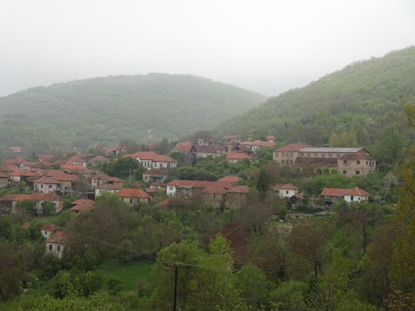
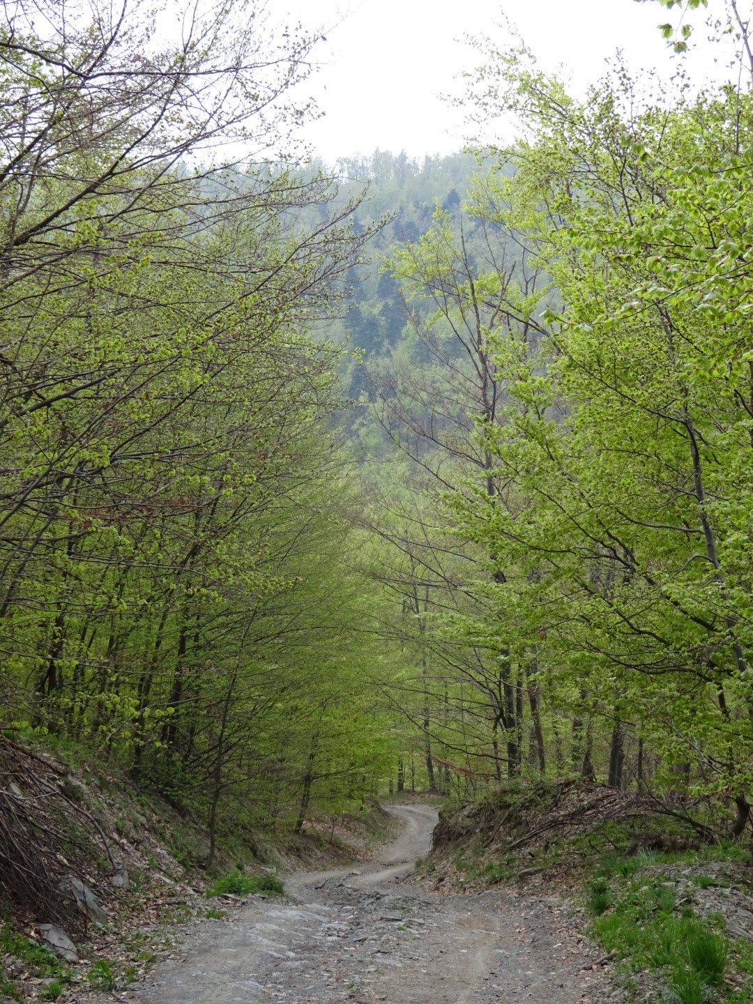
Apart from the flood plains of rivers, Southern Serbia is hilly or mountainous, the hill farms seem to cover a smaller area than those in Voyvodina, they generally have a few sheep, chickens, maybe goats or cows, a small field of maize, an orchard or a vineyard, not very specialized unlike the large arable farms in Vojvodina. The script is generally Cyrillic. In Southern Serbia there was a strong sense of rural depopulation, people leaving for jobs in Belgrade, Germany or Austria, leaving empty houses, some renovated and awaiting their return at a later stage in their lives. Those left are the elderly. As they die so their houses can become left to decay. The higher, more distant fields are no longer farmed and become covered with thorny, often impenetrable scrub, along with the tracks connecting them.
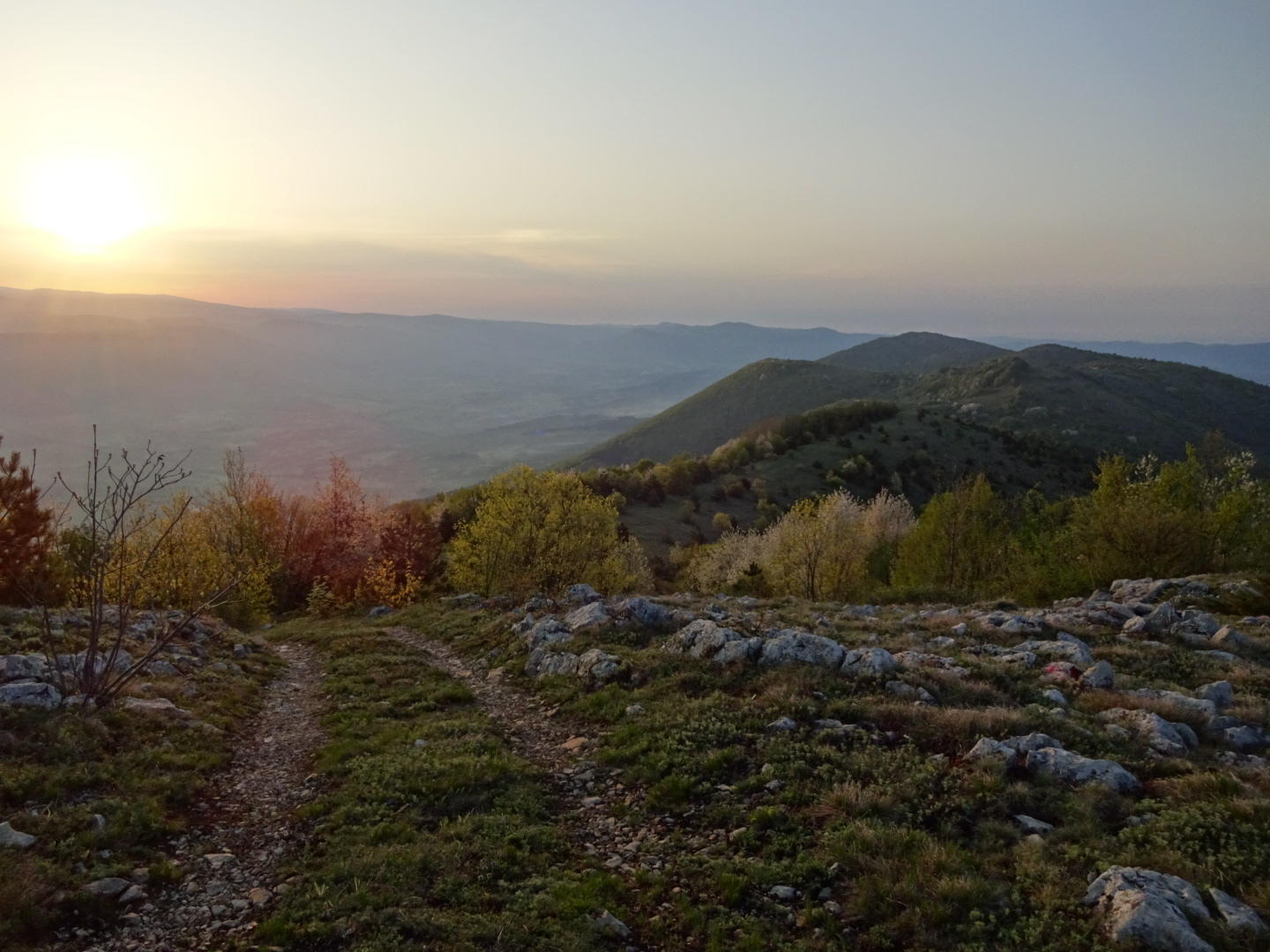
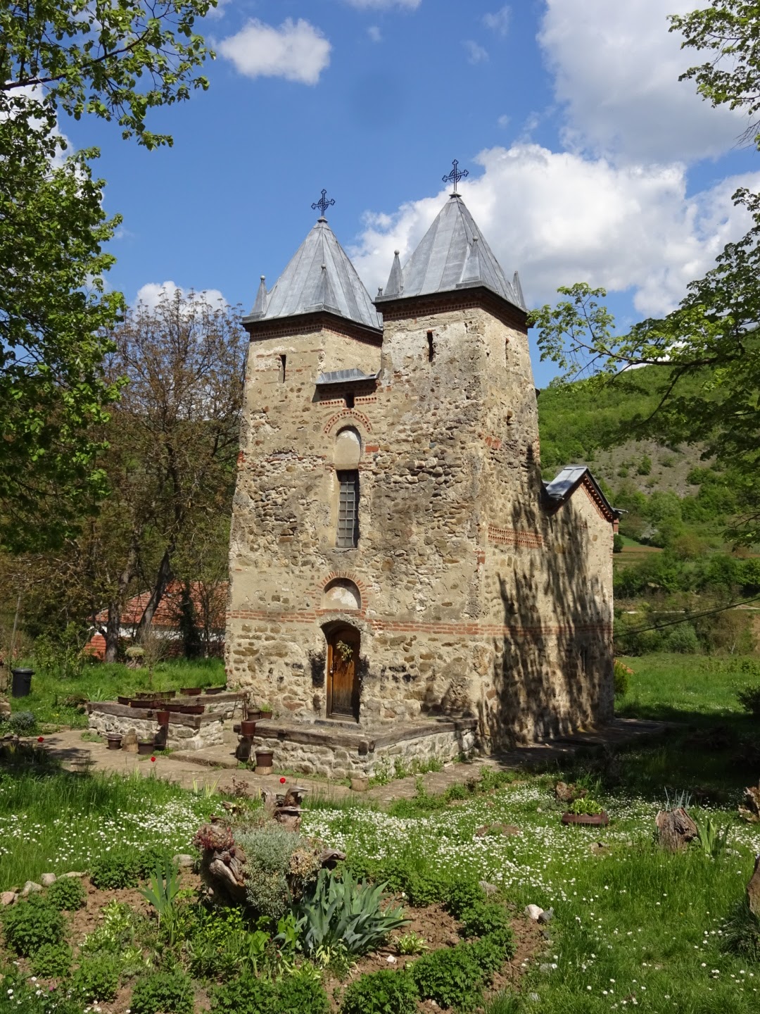
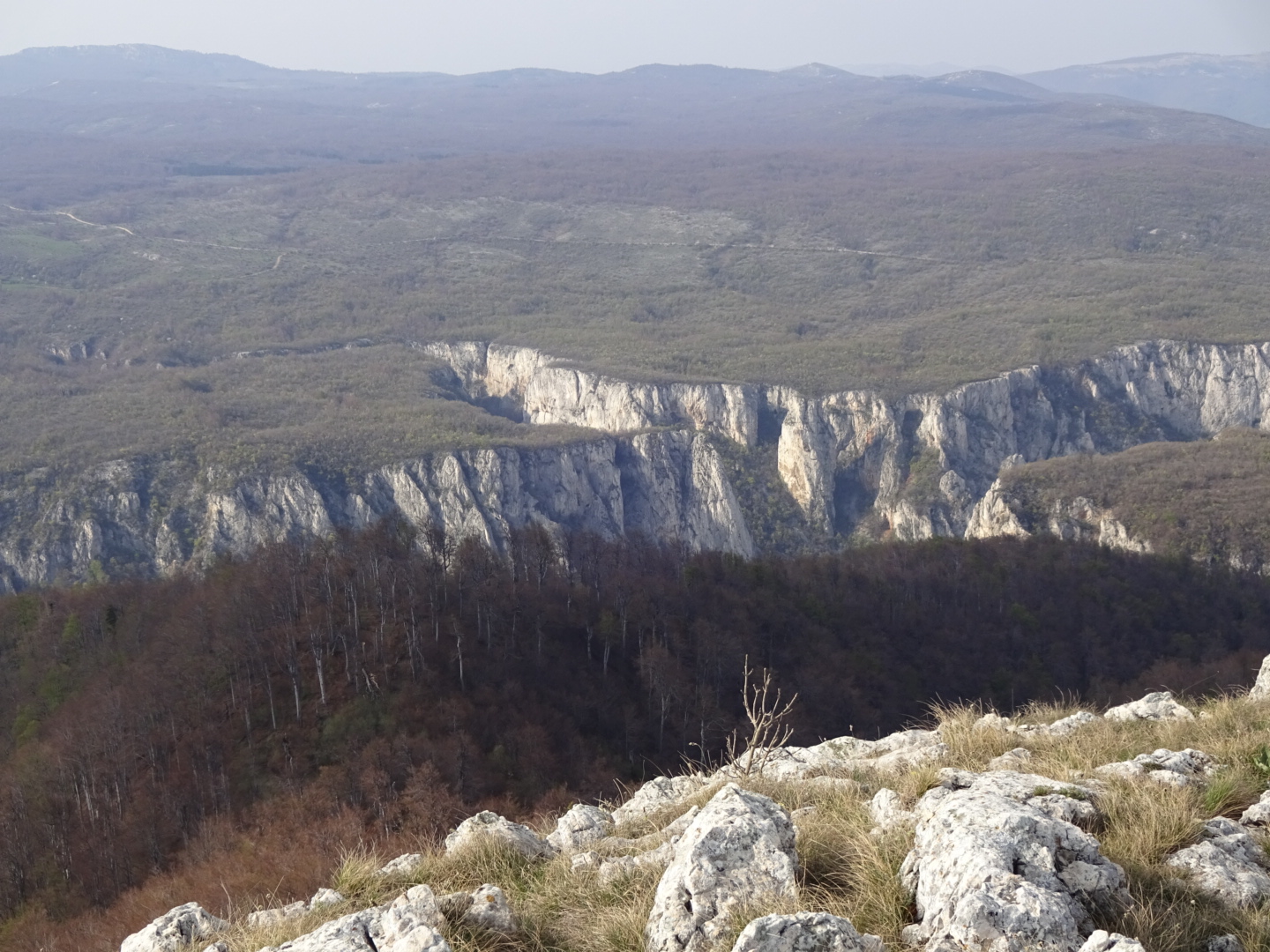
I have walked through some magnificent landscape in Southern Serbia. Many Serbian mountain groups make day visits to the great mountains and valleys such as Veliki Strbac, Rtanj and Babin Zub. However, long distance footpaths have not historically been a feature in Serbia; the E4, and it's sister the E7 are two created as a result of a European initiative (along with the Sultan's trail), and their development has been limited with, for example, no GPS files of the route being released, something that could be achieved at little cost. Walking alone is also something which surprises people here ("Sam?" I was asked in surprised tones). There is a lot of potential for more people to enjoy these paths if they were better known, not only is there landscapes to admire, there are also various historic and religious places of interest. The fortresses of Smederevo, Golubac, Ram and Sokobanya come to mind, and the monasteries of Tumane, Vratna and Bukovo. Natural phenomena range from the limestone bridges of Vratna canjon, to disappearing rivers or river sources such as Krupajsko Vrelo, there are caves a plenty, for example Ravništarka Pećina and canyons like the Lazarev gorge. Of mountains there is no shortage, from Beljanica to the view of the Iron Gates of the Danube, from Avala to the Stara Planina. Then there is the food, especially the Serbian cuisine offered at some of the private accommodation, along with a warming glass of rakia. For those of an engineering background such as myself places like Majdanpek and the Djerdap dam are fascinating. Clearly lots of reasons to walk through the southern part of Serbia.

The E4, as I have followed it in "Rambling through Serbia", is annoying in places, with some huge meanders to see particular locations, while obscurely avoiding major places like Negotin. The details of the route are also lacking and I hope the GPS files that I have linked to my blog will help others who follow in my footsteps. They were based on finding routes on Google Earth and various maps that seemed to match the trails marked on the small scale maps in "Rambling through Serbia". The maps I used included two GPS maps, Garmin's Adria and Navitrack's Balkan topographic maps, and maps copied from Tourist Information internet sites, the Djerdap Park map was especially useful. For gaining a general impression I bought the larger scale Freytag maps of North and South Serbia. There are detailed maps made by the Military Geographical Institute, but I had no response to my e-mail asking to buy copies. The Stara Planina and Suva Planina hiking maps, which can be purchased online, were also useful. However as rural depopulation occurs, some of the tracks on even the best maps, and on which the E4 relies, are becoming overgrown and will soon become impassable unless someone has responsibility for keeping them clear.

Accommodation is an issue and forced me to do more wild camping than I would like (although I had some beautiful mountain top campsites that I would not have wanted to miss). It helps enormously if places are on booking.com or some similar booking site that does not require a knowledge of Serbian, however there are many areas where lodgings are not covered by online reservation including some large hotels. There is private, bread and breakfast type accommodation listed on tourist association websites which covers many places the E4 passes through, but to stay at these you have to telephone. They are unlikely to speak English which is a problem. I had the additional problem that my phone with a British EE sim card would not connect with Serbian mobile phones. It is also no good just turning up at private accommodation, all you will find is a sign with a telephone number. On occasion I asked an English speaking receptionist or owner of the place I was staying at to ring ahead and book the next night's accommodation. With the notable exception of Zrenjamin, most tourist information offices will not book or even find details of accommodation outside their own municipalities (and often I found the Tourist Information offices closed).

I hope more people will follow in my footsteps, such people bring money into rural areas, and foreign visitors bring money into Serbia, which can only help limit the decline of rural communities. When to visit is something to consider. At the end of March I had snow and my water bottle started to freeze but just a few weeks later in April sweat was dripping off my nose as I climbed with the sun shining above me! Temperatures were however very pleasant for my trip in September and October of 2017. Many places were not open for the season until May 1.

The main negative to walking through Serbia are dogs. They bark at you as you walk through villages, fortunately most cannot reach you due to fences or chains, but there are loose dogs that come at you barking and baring their teeth. Serbia is a high risk country for rabies so a bite from a loose dog is potentially deadly and urgent medical attention is advised.

In general Serbians look pretty solemn as you pass them, just like the paintings on the walls of the churches. This and the barking dogs might make you feel unwelcome. This is not the case. Most of the Serbians I have spoken to are very friendly, many are curious, some even inviting me into their houses for a coffee or a rakia. A cheery "Dober Dan" (good day) does a lot to help break the ice, and even bring a smile to the face of an 80 year old lady dressed in black.

A final point - Serbian dinars are hard to change outside Serbia, there are a number of exchange places just before the border with Bulgaria, you might try there as I found nothing after the border.

Srećan Put!

For the start of my blog of walking through Serbia click here.
My journey continues in Bulgaria see johnpone4bulgaria.blogspot.com.

Update: the Mountaineering Association of Serbia now has a site for the E4 and E7, also see Rolf Gerstendorf website for the E8, he plans to follow part of the E4 in Serbia to fill in a gap in this trail.

Further Update: Based on my travels on the E4 I have written a book "Six Pairs of Boots: Spain to Cyprus on the E4 Trail" by John Pucknell available from Amazon.co.ukAmazon.com, the Bookdepository.comlehmanns.debookspot.nl, and other good online bookstores.

Another Update: As of October 2022, large sections of the E4 in Serbia are now available as gpx files from Traildino.com. OutdoorActive also has many parts of the Serbian E4 on its hiking layer in the maps on its App.

Me and my rucksack

To Dmitrovgrad in E4 Day 59

Today was my last full day of walking through Serbia on the E4 Long Distance European trail.
Waking up to a sunny day I headed downhill to the Monastery of Sv. Kirik i Julita. There should have been a path according to the map but not seeing one I headed down the ridge along the route it should take tramping on various herbs and flowers among the rocks which were trying to trip me up. The map indicated that the path should make a sharp right turn at the end of the ridge at a height of 1159 metres. On my way to this point I noticed a faint path crossing mine, but it was too far north to correspond to the one on the map. Having reached the end of the ridge and still seeing no path I followed the route such a path should take using my GPS, not so easy on the steep side of the ridge. Eventually I joined up with a path coming from the top of the ridge, I assume the one I saw earlier. This proved to be a good path taking me through trees to the Monastery so well hidden in the valley that you only saw it at the last moment. Just shows that maps, in this case the Geokarta Stara Planina mountain touristic map, are not to be relied upon. This was one of the few maps suitable for hiking that I could get, and while very useful it is not perfect.
I tried the door of the church and finding it open went in. A nun was just finishing some liturgy, so I waited with head respectfully bowed until she had finished. The smell of incense, the icons with their gold outlines, the candles and the bowing and gestures of those visiting give these places a quiet religious atmosphere directly linked with ancient times (although a stone outside suggested the church was built in the 19th century). On leaving the church the nun was convinced that I was trying to find the path up the mountain (it is not very obvious where it starts at the Monastery) while I tried to explain to no avail that I had just come that way. Again lack of language skills caused me a minor embarrassment but we said "Dovidenja" and I headed down the obvious tarmac road.
This took me to the village of Smilovci where there was a shop open so I sat on the bench outside and had a coke and Mars bar for breakfast while the shopkeeper and a man drinking beer next to me tried to ascertain what I was doing and then had a discussion that involved the words for English, Russian and Germans... The road took me by a lake, through another village and up two ridges before I turned off on a little detour indicated in "Rambling through Serbia". This avoid some tarmac but took me very close to the Bulgarian border. I was worried about being stopped by border police. You are meant to register with the police if you are camping, but for someone on foot camping in remote places this is not practical. It was not a subject I wanted to be questioned about, at least not unless I had stayed in a hotel the previous night and so had some recent documentation. Fortunately there were no border police on the track, just a few people digging holes who pointedly ignored me.
I reached the tiny village of Gradina and then headed for the Happy Hotel at Dmitrovgrad. Happy because it is a nice place serving food and drink on a pleasant terrace overlooking the town, not for any nefarious reason.
So here I am enjoying a small bottle of white wine to celebrate crossing Serbia, another country on my walk across Europe.

24.2 kilometres walked today, mainly downhill. A gpx file of my route can be found on wikiloc.com or the route can be downloaded from Outdooractive.

My journey continues in Bulgaria see johnpone4bulgaria.blogspot.com.

Morning view from my campsite

Dmitrovgrad, last town on my walk through Serbia

Tuesday 24 April 2018

Zavojsko Jezero to ridge after Slavinja on E4 Day 58

Quite a variety today, including a hefty 1430 metres of climbing according to my GPS.
Today started by continuing around the lake, passed a house close to my campsite, no doubt the source of the noise yesterday evening. Many such houses dotted the hillside at this end of the lake, all with good views. I shortly reached a junction with a track going back to the tarmac road that I would be following later. Possibly I should have taken it, instead I continued following the track around the lake as it became progressively less used. It was a shorter route by distance but as I left the lake and climbed up towards the road it became completely blocked by branches from some logging operation. I climbed a steep slope to get around them, struggling from one tree stump to another then worked my way back to the path higher up. It was then a few hours walk along the tarmac road. Cars passed with a frequency of one per hour. The lake was not visible from the road which was higher up the valley side but there were plenty of trees, meadows and hillsides to look at.
Reaching the village of Paklestica I topped up my water at the communal tap while inquisitive locals asked what I was doing. I have just about mastered the word for hiking and usually attempt to say the name of the place I am going, in this case a canyon (same word in Serbian). Seeing a British hiker around here is virtually unknown although an English cyclist on the Iron Curtain trail was reported. The village had some picnic tables by the river, with their conical sunshades looked like they belonged on a beach somewhere. I sat down on one and ate my breakfast enjoying the scenery, watched by an attentive dog who checked I did not leave any crumbs.
Some steep uphill walking along a path up a densely wooded slope followed. Rare red and white waymarks gave me some confidence that I was on the right path but were too few to stop me wasting a lot of energy climbing a steep, forestry track that ended abruptly forcing me to descend and pick an older, less obvious path. The path was meant to lead to the Visocica gorge but I was beginning to doubt I would see it through the trees when suddenly there it was. The path followed an old road built into the edge of the steep slope. Too steep and rocky for many trees allowing me to see the gorge far beneath me. It was an incised meander with steep, tree lined valley sides and some large cliffs.
After the overlook the path was more difficult to follow. As I brushed through trees my head, clothes and rucksack picked up tiny green caterpillars or grubs of some kind off the leaves.
My path joined another leading through fields to the village of Rsovci. I heard someone calling on my way but realised it was a shepherd trying get his flock to go somewhere and not addressed to me. I was hoping for a shop in Rsovci to stock up a little, there was one but it was closed with no opening times marked. A helpful man fetched the owner and I bought some snacks and an ice cream for myself and the helpful man. Unfortunately there was some confusion about money. I should have got the shopkeeper to write the amount I owed down, instead I gave more than enough notes and he returned some of the higher denominational ones. Then they confused me with a mixture of Serbian and German. There was a discussion about 2 Euro, 200 dinar and 20 something. I could not understand so after a while the shopkeeper just said OK. Not sure if I underpaid but the shopkeeper had a draw full of change so he could have accepted one of the larger denomination notes I offered. All very embarrassing.
The helpful man then showed me a chapel cut into the cliff on the other side of the river to the village. It included a fresco painted onto the side of the cave as well as numerous icons. It must be an important, local site of interest as a Bulgarian man on his motorcycle was also visiting.
Returning to the village and saying goodbye to my guide, I headed along the road to the villages of Visočka Ržana and Slavinja. After Slavinja I climbed out of the valley on some tracks, a long and (coming at the end of the day) a tiring climb. Once the track had zig-zagged its way to its highest point I turned off to walk up a grassy ridge to a nearby summit with a panoramic view to the north and south. Finding a flat spot, free of many rocks and with a few trees to break the wind I set up camp for the night.
As I finished my tea, waiting for the sunset, the sun which had been shinning for most of the last few days was blotted out by clouds. Towering cumulus clouds followed by lower, black, rain heavy clouds. As I retreated to my tent after checking my pegs and guylines, the wind started blowing and the first shower of rain began. I remember thinking I will never get to sleep due to worrying that the wind will collapse my tent. That was the last thought I remembered before slipping into the land of Nod.

34.5 kilometres walked today, with a 1430 metre ascent. A gpx file of my route can be found on wikiloc.com or the route can be downloaded from Outdooractive.

Visocica canyon

Path along side of Visocica canyon

Partially overgrown track after gorge

Shrine at Rsovci

Gathering clouds

Monday 23 April 2018

Babin Zub to Zavojsko Lake on E4 Day 57

A big descent into green, steep sided, wooded valleys which I followed to Zavojsko Jezero  (Zavojsko Lake).
Breakfast was another large meal following three yesterday so my tummy was well rounded as I descended from Babin Zub into the valley of the Rekitsa river, passing streams tumbling down the hillside in miniature waterfalls. The Rekitsa valley took me to the village of Topli Do which mainly consisted of empty houses and notices of people who had died. No barking dogs, just the occasional clink of distant cows bells. The dusty shop still had bags of crisps, packets of biscuits and bottles of pop, but it looked a long time since anything had been weighed on its old fashioned scales. A sign from Topli Do pointed the way to various impressive looking waterfalls a few hours walk uphill. Hopefully I will revisit the area someday, see some of these falls and traverse some of the high, open ridges but today I headed down the valley of the Toplodolska.
My route today was very clear in "Rambling through Serbia" and led me down a tarmac road beside the river. In my planning I thought traffic might be a problem but in two hours on the road only an old fashioned Renault 4, a Zastava and a six wheeled lorry passed (the lorry was matt green, short and squat, with large wheels, the type of thing that went up rutted forest tracks to fetch logs). The river, a tributary of the Tempska, carved its way through red sandstone (similar to the Old Red Sandstone of Devonian age in Britain), with small falls and lots of white water. It was generally hidden by the trees lining the road. In places where the valley grew narrow large promontories of rock squeezed the road higher up the valley sides.
I left the road I was following and walked up a valley joining from the east. This track would lead me to Zavojsko Jezero but first I had to ford the river I had been following. I removed my socks and replaced my boats, rolled up my trousers and prudently packed away my socks, camera, wallet and GPS in one of the dry bags I had for all my other belongings. Prudently, because as I splashed across slippery boulders in knee deep water I lost my balance. Catching myself with my hands I made my trousers and the front of my tee shirt wet. Later in the year I am sure crossing would be less of a problem. I walked on with my wet clothes letting the warm sun dry them out.
The lake was originally created by a landslip in 1963 displacing the local population. It was later drained and a dam built for hydroelectricity. Fortunately no signs or barriers stopped me crossing the dam and I continued along the road and then a track near the lakeside.
I had imagined camping by the lake but either the land fell steeply into the water or the lakeshore was occupied by boats, caravans or fishermen. The later also had little floating, wooden cabins moored on the lake. So I camped in what I thought was a nice, quiet spot in a flattish clearing in the woods. First I was attacked by mosquitoes, and now retreating into my tent to avoid bites I am listening to a load motor doing something with occasional accompaniment by a barking dog.

31.9 kilometres walked today, mainly downhill descending 1380 metres. A gpx file of my route can be found on wikiloc.com or the route can be downloaded from Outdooractive.

Largely abandoned village of Topli Do

Toplodolska river

Zavojsko Lake

Sunday 22 April 2018

Balta Berilovac to Babin Zub on E4 Day 56

A day of walking uphill, although without yesterday's problems with route finding.
After breakfast consisting of some interesting pastry things wrapped around in a spiral with yoghurt and cherry jam I was off down the road to where the track to the rocks of Babin Zub started. After fording a river, removing my socks so that they did not get as wet as my boots, the climb started. It was up through trees for the next few hours, first oak trees, their leaves bright green and freshly unfurled. Then some beech, and higher up silver birch with vivid leaves. Above them the buds on the trees had yet to burst, and there were many broken branches, maybe snapped by the weight of snow this winter. By Babin Zub itself there were no trees but instead creeping juniper.
Babin Zub means Grandma's tooth, although the mountain has a row of several large rock formations like a row of teeth. The Stara Planina resort was at the top of the track I had walked up, I had booked the Babin Zub guesthouse for the night, but was undecided whether to follow the road straight up to it or climb up to the rocks first. In the end I diverted up to the rocks, rewarded by views back to places I had been, places I would be going to and places, like the peak of Midzor one of the highest peaks in Serbia, which I would not manage to include in this trip. I tried hard to avoid stepping on the many purple crocuses that were bursting from the dead, yellowish grass.
Snow still interfered with short bits of my walk around Babin Zub, as you might expect given the height, the top of Babin Zub is at 1740 metres. Ski lifts and the paraphernalia of ski runs littered the area. I walked down a particularly steep "black run" to the "Ski Cafe" where I stopped for a cup of coffee, watching the people, younger than me, sitting on deckchairs with their beers, admiring the view.
My hotel was a short walk from the Cafe. Not for the first time booking.com had booked me as two people at the Babin Zub guesthouse. In compensation for paying the extra money for two, they gave me full board and I had a late, generously sized, lunch (just as well as the Ski Cafe where I hoped to eat was not serving food). Now the sun has just set with a display of pink and red bands beneath the darkening blue as I write this in the lounge bar of the hotel enjoying a quiet beer.

20.6 kilometres walked today but with a 1480 metre ascent. A gpx file of my route can be found on wikiloc.com or the route can be downloaded from Outddoractive.

The rocks of Babin Zub form a distance

There were lots of purple crocuses

Ski lifts making the mountain feel rather commercialised

Saturday 21 April 2018

Jalovik Izvor to Batla Berilovac on E4 Day 55

A long day of navigation challenges that can be split into three parts.
The first stage was to get from my campsite on top of the mountains to the road at the small village of Jalovik Izvor. Having watched the sunrise pink and orange above the Stara Planina mountains I walked down the valley. The planned route seemed to have disappeared but with the help of my map I found a route to Jalovik Izvor down another track, but not before after I attempted a path downhill that did not go anywhere, forcing me into a steep climb back up.
Having descended all the way to the village I viewed the locked up church with its separate bell tower. Then it was a climb up the other side of the valley for the second stage of my day to a settlement called Baldic, which did not appear to have anyone there, not even a dog, but it did have a spring where I filled up with water.
Then along a track through woods beside a mountain which ended at a junction. I had planned two possible routes from this junction but the upper route had the best track, so I took this. After a kilometre or so it ended in a meadow surrounded by trees with dense undergrowth, I pushed through the trees in one direction without reaching any path so I turned back and tried the other route. That ended in impenetrable thorny bushes of various types. There were the remains of an old stone building and the map had sheepfolds marked. It looked like pasture land that had been abandoned and taken over by vicious shrubs with sharp thorns. However I could see across the valley back to the previous track. Rather than ending in a meadow it looked like the track continued downhill into fields. So I returned and again tried the upper route and this time found a way out of the meadow through the trees to the farm of Glavcina below (not quite sure where I found that name but I had entered it in my GPS as an important waypoint during my planning before the trip). This farm had a few hens clucking and some freshly tilled fields although fortunately no sign of a dog.
I had spent over an hour and a lot of energy searching out the route, so from Glavcina I headed down to the main road by an obvious track. A kilometre south on the road was a pretty good waterfall with a stall selling homemade produce. Some Bulgarians on a day out from Sofia were buying some smoked(?) meat. Just beyond was a turn off for a monastery, some 1.2 kilometres away, but I was keen to start the third stage of my walk which involved crossing mountains to the Ćuštica road.
Here I met me nemesis. I followed my planned route for a few kilometres including some steep uphills. I then discovered that I had again picked a stream on Google Earth instead of a track. The woodland was dense with thorny shrubs, there was no means of following the stream and there was another 4 kilometres to reach the Ćuštica road. I had no alternative route planned and I had accommodation booked for the night, leaving no time for following random tracks that may or may not lead anywhere. So, very disappointed, I was forced to retrace my steps back to the road. To reach my B&B accommodation in the village of Batla Berilovac it was then a long, hot and dusty walk along roads. A coke at the large village of Kalna helped keep me going, where a few people practiced their English on me. The thought of a cold beer at the Villa Babin Zub (my B&B) was also an incentive. Altogether I walked 39 kilometres and climbed over 1100 metres, far more than intended.
In compensation, the said Villa Babin Zub proved very pleasant with a number of English speaking people staying. An Englishman among them was an excellent raconteur, keeping me amused with stories of his work, their walks in the mountains etc., his Serbian wife helped arranged a very welcome and absolutely gorgeous cold beer and dinner for me.  Some American visitors commented on the amount of food at dinner but I seemed to have little problem cleaning my plate after a long day.....helped by a glass of red wine and a walnut rakia with my coffee (the walnut rakia was a little on the sweet side, the plum was great).

Up to to Jalovik Izvor a gpx file of the trail can be downloaded from wikiloc.com, or the route can be found on ViewRanger as johnpon0031. For the trail after Jalovik Izvor village a gpx file of my route can be found on wikiloc.com or the route can be downloaded from Outdooractive.


Waterfall (Vodopad Bigar) with stall selling home made produce

Impenetrable thorny bushes blocking my way

Friday 20 April 2018

Knjaževac to Jalovik Izvor on E4 Day 54

More ascent than I expected otherwise a pleasant walk.
"Rambling through Serbia" shows the E4 missing the town of Knjaževac but I diverted into the town yesterday both to enjoy the accommodation and to stock up with supplies, I am sure most long distance walkers would do the same. Having stayed the night in the town I chose a convenient route out to avoid retracing my steps too much. I took a quiet tarmac road to the village of Crvenje, from which I could see distant mountains above the blossom of fruit trees beside the road.
After Crvenje, the route was on farm, forest or plain muddy tracks. In my planning I had imagined from the number of farms, settlements and fields on the satellite photos that it was undemanding if hilly terrain. In fact the valleys had steep sides and with two major ascents (and one descent between them) I climbed a cumulative total of 1344 metres according to my GPS. It was also more wooded that I expected.
I skirted the edge of the village of Mucibaba then ate my lunch (bought in Knjaževac before I left) in the village of Donja Kamenica. I sat on a bench in front of what may have once been a community hall, now used as a place for sticking up notices of those who had died. This was opposite a 14th century church. I would have liked to have seen the frescos inside referred to in "Rambling through Serbia" but the church was padlocked. There was a Tourist Information office opposite with a promising sign indicating it might sell coffee. Needless to say it was also locked.
After Donja Kamenica it was a track up a wooded valley which would pass close to the summit of the mountain of Cukar. As I neared the top of the trail it became progressively more overgrown until after the farming settlement of Golema Livada. The buildings here looked mostly abandoned. Then a bit of good trail passed the summit of Cukar, before turning off onto an overgrown track. Here I was following a hiking map of the Suva Planina, the corner of which covered the area I was walking through. Finally, a section of good track passed recent wood cutting activity and a goatherd with his white goats who wished to have a conversation in Serbian with me, but was disappointed.
My campsite is a spot high up with a 270 degree view of mountains and a lovely sense of space. The highest mountains in the Stara Planina area to the east still had streaks of snow, now coloured pink by the setting sun.

32.1 kilometres walked today with a 1344 metre ascent. A gpx file of the trail can be downloaded from wikiloc.com, or the route can be found on ViewRanger as johnpon0031.


Medieval Church of the Holy Mother of God in Donja Kamenica

Campsite for the night

Thursday 19 April 2018

Devica to Knjaževac on E4 Day 53

Another very pleasant day walking among trees, bushes and flowers.
Waking early I continued along the ridge on vehicle tracks following my planned route, enjoying the birdsong, the emptiness compared with city life. Initially I was looking down on clouds covering lower ground, with a reddish sky above, as I dropped in height I was in the cloud itself walking through mist. In places there were numerous crisscrossing vehicle tracks but later the track I was following disappeared in what looked like an area farmed long ago. There were indications with stones and bushes of field boundaries but thorny scrub had taken them over. Fortunately there were gaps between the bushes growing on the thin soil so I could find a way through to a later part of my route, where I picked another faint vehicle track. I followed this as it headed over a slight summit then downhill to the road gradually becoming clearer and more rutted.
The road took me through the large village of Beli Potok with its red tiled roofs. Like many villages in the area a number of buildings looked abandoned, others had gay, red and yellow tulips in their gardens.
A few kilometres down the road I was planning to turn off and find a track along the north side of a valley. I was concerned as I was not confident that the path I picked on Google Earth actually existed. Maybe I was skilled in interpreting satellite images, more likely I was lucky, the track was there and with a few deviations took me to a view from a grassy promontory of one of the tributaries of the Timok where I enjoyed lunch. It was a route blessed with meadows, dense with spring flowers.  Leaving the track I had been following I turned down one old and overgrown path to a rocky spur with a good view, but could not progress further. Fortunately the track I had been following took me through some tidy orchards to the road near the village of Rgoste. Then it was following the road into Knjaževac.
My entry to Knjaževac suggested the town is not a wealthy one, with horses tethered by the roadside and washing hung over nearby fences. However the centre had a pleasant riverside walk, shops to stock up on food and my hotel is fine. I did however see a youth steal some Ice lollies from a shop and run off...

34 kilometres walked today. A gpx file of the trail can be downloaded from wikiloc.com, or the route can be found on ViewRanger as johnpon0031.

Morning view from my hilltop campsite

Village of Beli Potok with its red tiled roofs in the morning mist

Track through flowers filled meadows

Wednesday 18 April 2018

Sokobanja to Devica on E4 Day 52

A lovely walk today, much of it on walker's footpaths (rather than farm or forest tracks) and an intriguing ruined fortress.
It was sad leaving Sokobanja. I enjoyed the food last night at the Cafe Amam, the grilled chicken had some kind of pepper seasoning and the baklava dessert had a lemon offsetting the sweetness. Paul Hollywood was baking on one of the cafe's TV screens. I was just discovering which cafés sold slices of cake. As I collected some lunch before breakfast from a pekara (bakery) people were busy cleaning the streets of rubbish, few places in Serbia are as clean and tidy as Sokobanja!
The rain stopped soon after I started my day's walk, fortunate as I was soon overheating in my rain jacket as I climbed the winding road out of town towards the ruins of the medieval fortress of Sokograd. Leaving town the road entered trees with a little church on the right and a few views back. After the tarmac ended at a car park & picnic site I continued along a riverside path before climbing to the ruins. These were partly hidden by trees, giving the place an undiscovered feel, somewhere Indiana Jones might visit (although the lilac bushes with their purple flowers did not quite fit that image). The towers and remaining walls were on the side of a limestone gorge and it looked more a place to hide from the enemy rather than defend your kingdom.
A good path contoured the steep sided valley and then made a strenuous climb uphill, eventually turning back on itself to reach a vantage point with an excellent view down onto the castle. I followed the red and white trail markings on this route, continuing to follow them up to the summit of Ostra Cuka and on along the Devica range to Čaplijnac, its highest point.
Up until Ostra Cuka most of the trail was through forest but the summit was a rocky outcrop without trees, just rock, grass and thorny bushes, plus a shiny metal cross. The views would have been great but clouds got in the way. To reach Čaplijnac the route skipped between tracks and open ground, where you picked your way through rocks and bushes trying to spot the next red and white waymark. The summit of Čaplijnac was a disappointment, too hedged in by trees, with chunks of rock that tried to trip you up.
The waymarks sadly ended here and I made my way downhill to a faint vehicle track I had seen on Google Earth. Not simple, in addition to dense trees, branches, rocks and undergrowth around the summit there was a large circular depression, a thick layer of branches possibly hid a sinkhole leading to underground caves... By retracing some of my steps and then heading across rocky grassland and scrub I found the vehicle track I looking for. I followed it, occasionally switching to intersecting tracks, almost all the way to my final summit of Caske. In many places the tracks were blue with flowers like miniature hyacinths, flowers I had first seen on Rtanj. Yellow cowslips preferred locations each side of the track. There was just one struggle through bushes shortly before I reached my final summit.
Caske was I felt the best of the three summits I visited today in terms of the panorama you could see. I also liked its remoteness, far from any habitation, a peace that comes of being surrounded by empty open space. I left on a route from Wikiloc.com, following faint vehicle tracks and before too long set up camp in a flat, grassy and pleasant spot on the ridge at around 1000 metres. One of my better campsites.

23.6 kilometres walked today, but an ascent of 1570 metres. A gpx file of the trail can be downloaded from wikiloc.com, or the route can be found on ViewRanger as johnpon0031.

Fortress of Sokograd

My route picked out by blue flowers

Tuesday 17 April 2018

Rest day in Sokobanya Day 51

After three long days, each of over 30 kilometres with lots of climbing, I was tired and my hips were aching. Time for a rest and the Tourist town of Sokobanya seemed an ideal choice, especially as the B&B Nataly is very nice, so good I rather over-ate at breakfast. The town has pedestrianised streets, lots of pavement cafés and areas of park with trees and borders planted with pansies, the purple and white displays looking very fetching. There were lines of young school children being led around by teachers, from the old Turkish hammam to the church to a Tito era hotel, a school camp maybe? As the Tourist Information office was closed until May the receptionist at the B&B helped book a hotel for the day after tomorrow.
B&B Nataly also had a small swimming pool and spa, so my exercise for the morning was to find some swimming trunks ("kupaci kostim" in Serbian, the helpful receptionist wrote it down for me to show shopkeepers). I found them in a sports shop. Following my success it was a swim and a massage in the afternoon.
Now thinking of where to eat dinner.

Pedestrianised area in Sokobanja


Monday 16 April 2018

Rtanj to Sokobanja on E4 Day 50

A steep climb up Rtanj mountain through the clouds followed by a long walk down to Sokobanja.
As I ate my fried eggs and a sort of ricotta type cheese for breakfast I peered up at low cloud hiding  higher ground from my sight. Not promising for any scenic views today. Despite the poor outlook for visibility and fortified by what I took to be Rtanj tea with my breakfast I started my day's walk in good cheer. After leaving the village the climb up to the summit of Rtanj mountain fell into three parts: a steep section through small trees and bushes to the top of a reef of limestone; a flattish section, then a second steep section through open grassland to the summit. As I climbed the flora changed from cowslips to flowers like miniature hyacinths that formed pools of blue on the higher slopes, to what looked like purple anenomies near the top. As I climbed above 1000 metres I began to look down from above on the clouds covering lower ground, a sight I always find impressive reminding me of my first time in an aeroplane. Near the top the wind became stronger, cold and gusting, with a good gale blowing at the summit. The ruins of St George's chapel at the top where I sheltered were only visible when I actually reached them. Various oddments had been left in a steel box by previous visitors. Despite it being somewhat misty I could see many distant mountains and valleys filled with cloud.
Descending, the path on my Garmin GPS map no longer seemed to exist so I just headed down the grassy slope trying to avoid the flowers, creating an oregano sort of herby smell as I crushed the vegetation with my boots. A pair of birds flew off startled by my approach. There probably was a better (less ecologically damaging) path if I had retraced my steps a bit further down, as it was I joined up with a tractor path as I reached the bottom of the steepest section.
This led me to a good, waymarked track which I followed to the village of Muzinac. Then it was by road to Sarbanovac and finally by gravel and tarmac roads to Sokobanja. A driver who stopped said there was a path to Sokobanja with better views along the top of the ridge. (Update: probably the one on the gpx trail subsequently published by the Mountaineering Association of Serbia)
By the time I approached the town it was raining. Not bothering with my waterproof over-trousers (a mistake) I hurried to Nataly's B&B for a warm shower, and later (after trying on the white fluffy bathrobe) a dinner of pork, chips and Sopska salad, washed down with the local beer.

30.2 kilometres walked today with a total ascent of 1233 metres. A gpx file of my route can be found on wikiloc.com or can be downloaded from ViewRanger short code johnpon0030.


Anenomies near the summit of Rtnaj

View from Rtanj summit

Track to Sokobanja, looking back at Rtanj

Sunday 15 April 2018

Malinik to Rtanj village on E4 Day 49

A long walk ending at the curious village of Rtanj.
I noticed a lack of birdsong this morning and my clothes were damp. On peering out of my tent I saw the summit of Malinik hidden in cloud and the day grey and overcast. Packing up as quickly as I could, but still taking the usual one hour, I started down to the village of Podgorac. After an initial section where I had to be careful to pick the right track, the remainder of the route was straightforward. All the way down the valley to the village I was surrounded by trees, their bright green leaves just starting to unfurl. Fortunately I could just splash across the two fords on the way.
At Podgorac I bought some food, the shopkeeper waited impatiently while I searched for something suitable. After drinking a coke on the bench outside the shop with some men with empty beer bottles, I set off avoiding the main road by making my way through a complex network of farm tracks, woodland paths and gravel roads to Boljevac. The route went via the village of Mali Izvor (little spring) where I washed the sweat off my face at the perfectly adequate piped spring.
On reaching Boljevac at lunchtime I was pleased to find a bakery open (despite being Sunday) where I had a slice of Pizza and a drinking yoghurt at the tables and chairs provided, followed by a coffee at the bar opposite.
Then it was just over 10 kilometres along the road to Rtanj. I diverted off the road for a while onto a parallel track, getting a bit mixed up among some charcoal burners (the path goes to the left of them), a lot of these burners were active today with smoke coming from their bases. Some of the track was overgrown but it did not obstruct me too much. The track ended at the village of Ilino where I rejoined the road. There was probably a way across the mountain between me and the village of Rtanj, but I could not find one in my researches and after walking 35 kilometres I decided to stick with the road which curled around the high ground but was still a bit of a climb. (Update: A gpx trail which includes the route over the mountain has now been published by the Mountaineering Association of Serbia)
Rtanj village was a surprise, I was expecting a typical Serbian mountain hamlet, but instead it was a ghost town left by an old mining operation with many abandoned buildings. The ruins were not picturesque. There were some occupied houses, a few quite smart, several advertising Rtanj tea, made from a herb that only grows on the mountain of Rtanj next to the village and on one or two nearby mountains.
The B&B Radgost was not where it was shown on Booking.com and its only sign said Apartments (in Cyrillic script). I only went in because on asking a local (by showing him the name on my phone) he made swimming actions, referring to the pool beside the B&B. There was a party drinking inside, who had just walked down from the summit of Rtanj mountain. I eventually determined it was the right place thanks to a friendly man who spoke English who told me a great deal about Rtanj. If I understood correctly he had an organisation called "the spirit of Rtanj pyramid". It seems the pyramid shape of the mountain has great significance, strange balls of light have been seen and there was something about frequencies, other emissions, and intersecting energy lines.
Certainly it will be my highest Serbian mountain so far at 1570 metres and the sides are very steep so I think an early night to prepare myself for whatever it has to offer.

40.3 kilometres walked today. A gpx file of my route can be found on wikiloc.com or can be downloaded from ViewRanger short code johnpon0030.

Track down to Podgorac

Typical farm buildings

Overgrown path near Ilino

Saturday 14 April 2018

Borsko Jezero to Malinik on E4 Day 48

Highlights today were the Lazarev Canyon and meeting a hiking group.
First, breakfast at the Villa Ljubicic. The owner seemed perplexed that I did not want a rakia to start my day, I will evidently not make a real Serbian man without a shot of this highly alcoholic spirit first thing in the morning! Then it was a gentle walk on the footpaths around the tree lined lake followed by a steep climb up the mountain of Tilva Njagra. I was not sure which track to take after the houses but the woods covering the mountain's east side lacked much undergrowth so I just headed uphill. There were two groups of rocks at the top to climb onto to get a bit of a view through the trees, I thought I could make out Lazarev Canyon, my next stop. I had a GPS track from Wikiloc.com giving me the way down, it took a little trouble to find the start of the path but after that it was a good trail, marked intermittently by red and white waymarks.
These waymarks continued all the way to Lazarev canyon, along farm tracks across green fields, and then tarmaced road. I had planned a more adventurous route to the west of the road, avoiding the section of tarmac but it required crossing a river at a weir. There were concrete blocks that should have helped a crossing but the river level was high and fast moving water covered the blocks. I decided the road alternative was safer.
I diverted to see the Lazarev caves at the entrance to the canyon. They were closed so I walked a little way up the north side of the valley in the sun on a concrete path to admire the deep, rocky gorge ahead. As I walked, lizards which had been sunning themselves on the warm concrete, scurried off the path ahead of me.
However my route was up the ridge to the south of the canyon, which would eventually reach the summit of Malinik, so I returned to the road and then headed off across fields to the start of my climb. This proved very steep. As I climbed through rather stunted trees, up a path, floored with limestone, the sweat rolled into my eyes making them sting and formed droplets which fell off the end of my nose. I was pleased to see some red and yellow waymarks, these indicated I was on the Serbian section of the E4, this was one of the few places the waymarks had been painted.
At around 700 metres the path levelled off for a while and in a meadow sprinkled with cowslips I met a hiking group from Serbia4youth (www.serbia4youth.org) - check out the website it covers a lot more than hiking trips. Their Mountain Leader, Nemanja Nikolic, spoke excellent English and made me welcome, and they also had a Mountain Guide from the local Dubasnica Mountain Society. Together we walked to a nearby lookout point where you could see the huge limestone buttresses forming the deep gorge, one or two trees were somehow able to grow out of the side of these cliffs. Then a group photo with the hiking group before I had to go. All the young people made me feel old and clumsy, and while pondering on the matter I walked into a tree! There was a spring near the lookout point, very welcome as climbing in the heat was thirsty work and I was going through a lot of water. I was glad it was April and not the heat of August.
More climbing and I reached another great viewpoint where much of the canyon could be seen, although the heat haze made for poor photos. After some pleasant walking through scrubby vegetation from where I could see back to the mines of Bor there was a final steep and slippery climb through mature trees to the summit of Malinik. The trees meant you could not see that much from the summit. The red and yellow E4 waymarks also ended at this point.
I followed a forest track down as it circled around the mountain. There were some flat areas of grass at around 900 metres and I decided to camp here. It left a long walk tomorrow but the GPS map suggested steep sided valleys after this point and I wanted a nice camping spot tonight.
I am now watching darkness fall as the last of the light disappears behind distant mountains.

30 kilometres walked today but with a total ascent of 1485 metres there was a lot of climbing. A gpx file of my route can be found on wikiloc.com or can be downloaded from ViewRanger short code johnpon0030.


Hiking group from Serbia4Youth

Lazarev canyon

Tree growing out of the side of the cliffs


Friday 13 April 2018

Railway line to Borsko Jezero on E4 Day 47

The sound of some animal around the tent woke me at 5:30 am. I thought a deer but as I reached for my glasses to check the time it started barking followed by all the dogs on all the farms within a few kilometres. Not being sure if it was a vicious biting dog I decided to stay still until it lost interest and wandered off. 45 minutes later all was quiet and I thought it safe to start decamping up. I had finished packing and was just checking I had left nothing behind when I saw two dogs looking at me, one a dirty yellow and the other larger one with a bit of husky in him somewhere. Fortunately they were not the biting kind and I cautiously headed on my way.
After several turns at various junctions by farms and through woods I was feeling relieved I had researched the route on Google Earth. A later track seemed to be an old railway line, with embankments and cuttings through volcanic rock. My planned route took me below the dam that created the lake of Borsko Jezero ("Jezero" means lake), however I had now been told by two different people that I would not be allowed to go that way. So as I neared the lake I switched to Google Maps for navigation and went around the north side of the lake (I had downloaded the map so that I could use it offline). One incident with a black dog on the loose barking and baring its teeth at me made me nervous. I picked up some stones in case he came too close.
At 10:00 am I was far too early for the room that my kind host at Negotin had booked for me at Villa Ljubicic, but with little to lose I called at the house and after some calls to Negotin for translation (the owner's spoke no English and I no Serbian), I had my room, coffee, breakfast and later at 4:30 pm also a meal of lettuce, cheese, soup, grilled pork, onions, rakia and beer. The best possible outcome.
Borsko Jezero is an artificial lake with many headlands and inlets, trees adding to its beauty. It had some fishermen, cafés  (most still closed for the season) and a 4 star hotel (apparently full for the weekend). Outside the hotel was a statue of a miner, the nearby town of Bor being a mining area. One of the nice things about former socialist countries is that they are not afraid to glorify working people. Pathways go around part of the lake, with some neatly cropped grass, benches, picnic tables and some pleasant trees, their bright green leaves just appearing.

On 11.4 kilometres walked today, so effectively a rest day! A gpx file of my route can be found on wikiloc.com or can be downloaded from ViewRanger short code johnpon0030.

Borsko Jezero

Borsko Jezero


Thursday 12 April 2018

Sikole to a railway line on E4 Day 46

I woke in the night to the sound of birdsong but checking my watch I found it was only 2:30 am. A nightingale perhaps? As I drifted back to sleep I thought of my mother saying that if there was reincarnation she would come back as a bird, maybe this was her singing me to sleep.
Next time I woke to birdsong it was 5:30 am and I prepared to break camp. It was a sunny day and a pleasant walk up through trees culminating in the sight of the mountain of Stol across the valley, its gray cliffs facing me. I was not climbing Stol but crossing a saddle to the north west of it. Even so it was a climb up to 900 metres with views back to the mountain of Deli Jovan. This was a key point on my trip when the E4 stopped making extravagant meanders and started heading more consistently southwards, towards Sofia in Bulgaria.
On the other side of the saddle I crossed over to a mountain hut maintained by the local Mountain Society. To my surprise it was open and I asked about the route down from the next mountain, Veliki Krs. While the route up was clear from my research I could not work out how to get down on the south west side of it, pictures and satellite photos suggested impenetrable bushes. The caretaker kindly found someone who spoke English after we failed in using Google Translate on my mobile phone. When he arrived 5 minutes later he advised going around the mountain it instead of over it. This was a disappointment as the summit of Veliki Krs looked really good on pictures on the internet and YouTube videos. A bed in the hut was offered and although I had planned to stay there, it was still before midday and as I had not done any planning on the revised route it seemed prudent to carry on. First my name was entered in the visitor's book and I was told the story of the Belgian who walked the E4 through Serbia with the help of  local Mountain Societies. Rather than continuing on the E4 after Serbia he was headed for Istanbul but was stopped at the Turkish border because of his dog.
To go around the mountain of Veliki Krs I walked a road route through the village of Veliki Krivelj (big Krivelj), probably not the route they were trying to explain to me at the Mountain Hut which involved Mali Krivelj (small Krivelj), but one I could find on my GPS maps and so reliably follow. If you know of a better route please make a comment below and load on GPS file onto some suitable site. On the way to Veliki Krivelj I saw the edge of an area of mining waste, the nearby city of Bor is a major copper mining centre.
Veliki Krivelj seemed a pleasant place. I topped up with water at the war memorial (copying a local woman) and bought a Sprite and a bar of chocolate at the shop which I consumed on the bench outside (second bar of chocolate of the day, I know, terrible at around 500 kcal each).
A rusted and now illegible sign that might have said no pedestrians unnerved me on the next stretch of road so I hurried on thinking of where I might camp. Turning onto a track for the next section I was in a narrow valley with few camping spots and even fewer not visible to nearby farms. I eventually crossed below a railway viaduct. It was a matter of camping close to the road (I generally like a more hidden spot) or arriving in Borsko Jezero in the dark. I chose the former and am now settled in a patch of nettles by a small stream, a place I hope nobody cares about.

30.9 kilometres walked today with a 925 metre ascent. A gpx file of my route can be downloaded from wikiloc.com or wandermap.net. The route can also be downloaded from my.viewranger.com as johnpon0029.

The mountain of Stol, my path took me over the saddle to the right

Wednesday 11 April 2018

Rajac to Sikole on E4 Day 45

Today was one of walking across hills in the sun on tracks and roads, past vineyards, by fields and through woods, it included a major fight through thorny undergrowth.
First it was breakfast, stingy nettle pie, which also had cheese and eggs in a sort of bready base - very nice and enough left over for my lunch. The first section of the walk was from Rajac to Tamnič.  I had some doubts about the farm track between the two villages that I picked on Google Earth but my host at the B&B confirmed its existence, drew a sketch map and took me to where it started. However in such tracks between villages farmers tend to go drive up and down from their fields to the nearest village leaving the middle or highest section of track little used and often overgrown, as it was in this case. Fields in this middle section most distant from the villages had also been abandoned, where once there may have been vines, there were now blossoming, thorny bushes difficult to pass through. The track itself, although marked by lines of small trees, became impassable as hawthorn, rose briars and similar thorny bushes tried to damage my clothing and penetrate my skin with some success. I tried to find an alternative path up and down the hillside, but no avail. Eventually I managed to bypass the most overgrown section of track. After negotiating some fallen trees the track began to improve as I approached the fields around Tamnič, where elderly women were busy planting potatoes while men did things with tractors.
I continued along my planned route without any other obstructions eventually reaching a tree fringed lake with a sad abandoned restaurant and leisure facility. Following the north side of the lake on a track through the trees I reached a major road, but only after crossing a deep, narrow, steep sided drainage channel. I had planned to cross some more fields on the other side of the road but with no sign of a track I elected to follow the main road for a while instead, keeping out of the way of the occasional truck and lorry.
I was offered a lift in a trailer behind a tractor for a second time and a van also stopped to ask if I wanted a lift. It was getting increasingly difficult to persuade people I wanted to walk. They obviously thought me very silly (could they be right?) so I was glad to turn off the road onto a track towards the village of Sikole, and after a final bit of road, passing locals getting ready for a football match, I reached the village shop. I topped up with water, bought a twix and a small can of beer which I drank on the bench outside the shop with fellow drinkers. A reward for a 30 kilometre hike on a hot day. Leaving the village I passed a place selling (?) wooden carvings of animals, people and ingenious swans made of old car tyres.
Now pitched on a grassy patch in some woods a few kilometres out from the village. Dear are barking but I don't think it's the hunting season so we should both be safe.

34.1 kilometres walked today. A gpx file of my route can be downloaded from wikiloc.com or wandermap.net. The route can also be downloaded from my.viewranger.com as johnpon0029.


Road section

Lake with abandoned restaurant