Highlights today were the Lazarev Canyon and meeting a hiking group.
First, breakfast at the Villa Ljubicic. The owner seemed perplexed that I did not want a rakia to start my day, I will evidently not make a real Serbian man without a shot of this highly alcoholic spirit first thing in the morning! Then it was a gentle walk on the footpaths around the tree lined lake followed by a steep climb up the mountain of Tilva Njagra. I was not sure which track to take after the houses but the woods covering the mountain's east side lacked much undergrowth so I just headed uphill. There were two groups of rocks at the top to climb onto to get a bit of a view through the trees, I thought I could make out Lazarev Canyon, my next stop. I had a GPS track from Wikiloc.com giving me the way down, it took a little trouble to find the start of the path but after that it was a good trail, marked intermittently by red and white waymarks.
These waymarks continued all the way to Lazarev canyon, along farm tracks across green fields, and then tarmaced road. I had planned a more adventurous route to the west of the road, avoiding the section of tarmac but it required crossing a river at a weir. There were concrete blocks that should have helped a crossing but the river level was high and fast moving water covered the blocks. I decided the road alternative was safer.
I diverted to see the Lazarev caves at the entrance to the canyon. They were closed so I walked a little way up the north side of the valley in the sun on a concrete path to admire the deep, rocky gorge ahead. As I walked, lizards which had been sunning themselves on the warm concrete, scurried off the path ahead of me.
However my route was up the ridge to the south of the canyon, which would eventually reach the summit of Malinik, so I returned to the road and then headed off across fields to the start of my climb. This proved very steep. As I climbed through rather stunted trees, up a path, floored with limestone, the sweat rolled into my eyes making them sting and formed droplets which fell off the end of my nose. I was pleased to see some red and yellow waymarks, these indicated I was on the Serbian section of the E4, this was one of the few places the waymarks had been painted.
At around 700 metres the path levelled off for a while and in a meadow sprinkled with cowslips I met a hiking group from Serbia4youth (www.serbia4youth.org) - check out the website it covers a lot more than hiking trips. Their Mountain Leader, Nemanja Nikolic, spoke excellent English and made me welcome, and they also had a Mountain Guide from the local Dubasnica Mountain Society. Together we walked to a nearby lookout point where you could see the huge limestone buttresses forming the deep gorge, one or two trees were somehow able to grow out of the side of these cliffs. Then a group photo with the hiking group before I had to go. All the young people made me feel old and clumsy, and while pondering on the matter I walked into a tree! There was a spring near the lookout point, very welcome as climbing in the heat was thirsty work and I was going through a lot of water. I was glad it was April and not the heat of August.
More climbing and I reached another great viewpoint where much of the canyon could be seen, although the heat haze made for poor photos. After some pleasant walking through scrubby vegetation from where I could see back to the mines of Bor there was a final steep and slippery climb through mature trees to the summit of Malinik. The trees meant you could not see that much from the summit. The red and yellow E4 waymarks also ended at this point.
I followed a forest track down as it circled around the mountain. There were some flat areas of grass at around 900 metres and I decided to camp here. It left a long walk tomorrow but the GPS map suggested steep sided valleys after this point and I wanted a nice camping spot tonight.
I am now watching darkness fall as the last of the light disappears behind distant mountains.
30 kilometres walked today but with a total ascent of 1485 metres there was a lot of climbing. A gpx file of my route can be found on wikiloc.com or can be downloaded from ViewRanger short code johnpon0030.
 |
| Hiking group from Serbia4Youth |
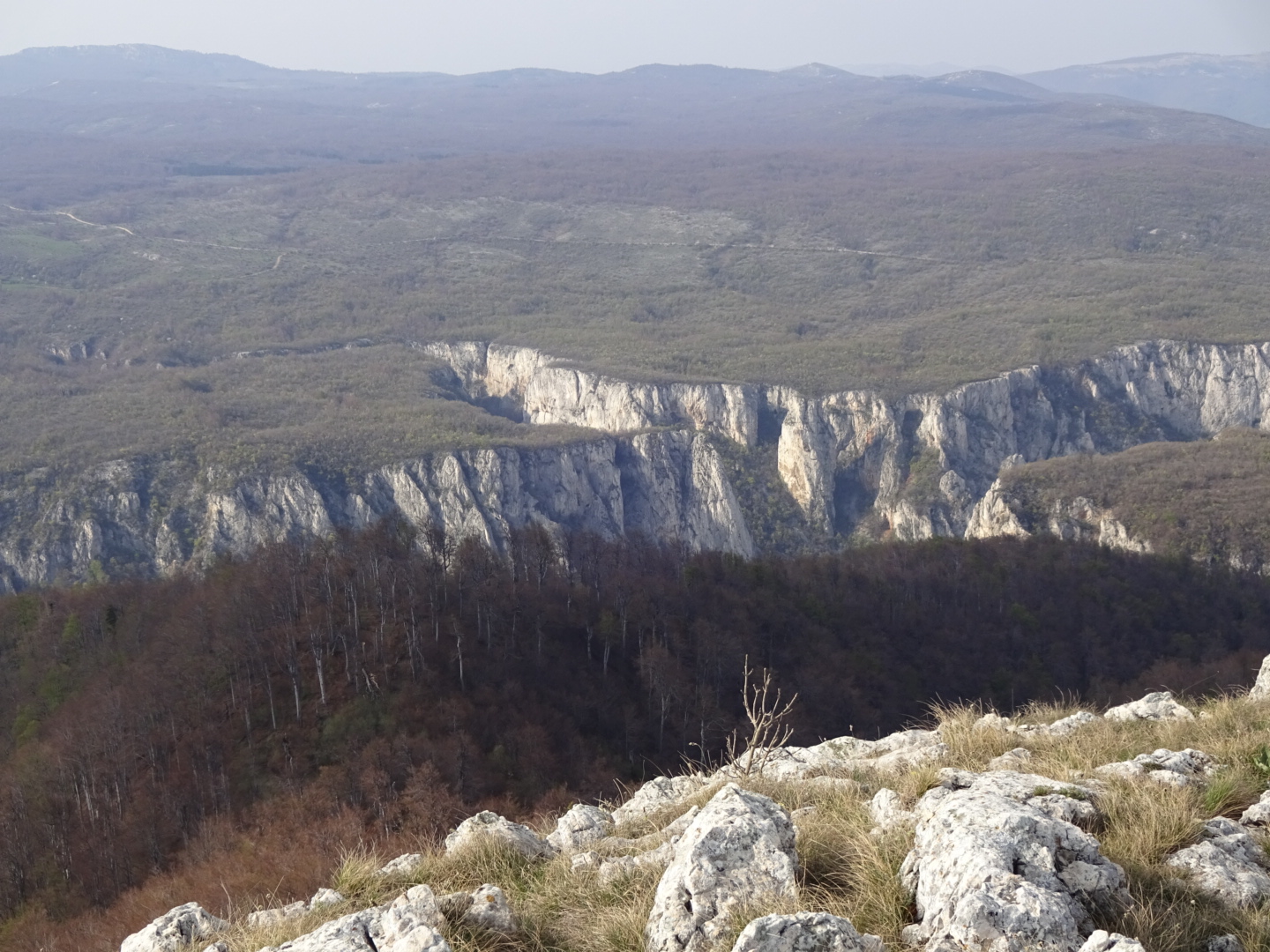 |
| Lazarev canyon |
 |
| Tree growing out of the side of the cliffs |
No comments:
Post a Comment