More ascent than I expected otherwise a pleasant walk.
"Rambling through Serbia" shows the E4 missing the town of Knjaževac but I diverted into the town yesterday both to enjoy the accommodation and to stock up with supplies, I am sure most long distance walkers would do the same. Having stayed the night in the town I chose a convenient route out to avoid retracing my steps too much. I took a quiet tarmac road to the village of Crvenje, from which I could see distant mountains above the blossom of fruit trees beside the road.
After Crvenje, the route was on farm, forest or plain muddy tracks. In my planning I had imagined from the number of farms, settlements and fields on the satellite photos that it was undemanding if hilly terrain. In fact the valleys had steep sides and with two major ascents (and one descent between them) I climbed a cumulative total of 1344 metres according to my GPS. It was also more wooded that I expected.
I skirted the edge of the village of Mucibaba then ate my lunch (bought in Knjaževac before I left) in the village of Donja Kamenica. I sat on a bench in front of what may have once been a community hall, now used as a place for sticking up notices of those who had died. This was opposite a 14th century church. I would have liked to have seen the frescos inside referred to in "Rambling through Serbia" but the church was padlocked. There was a Tourist Information office opposite with a promising sign indicating it might sell coffee. Needless to say it was also locked.
After Donja Kamenica it was a track up a wooded valley which would pass close to the summit of the mountain of Cukar. As I neared the top of the trail it became progressively more overgrown until after the farming settlement of Golema Livada. The buildings here looked mostly abandoned. Then a bit of good trail passed the summit of Cukar, before turning off onto an overgrown track. Here I was following a hiking map of the Suva Planina, the corner of which covered the area I was walking through. Finally, a section of good track passed recent wood cutting activity and a goatherd with his white goats who wished to have a conversation in Serbian with me, but was disappointed.
My campsite is a spot high up with a 270 degree view of mountains and a lovely sense of space. The highest mountains in the Stara Planina area to the east still had streaks of snow, now coloured pink by the setting sun.
32.1 kilometres walked today with a 1344 metre ascent. A gpx file of the trail can be downloaded from wikiloc.com, or the route can be found on ViewRanger as johnpon0031.
"Rambling through Serbia" shows the E4 missing the town of Knjaževac but I diverted into the town yesterday both to enjoy the accommodation and to stock up with supplies, I am sure most long distance walkers would do the same. Having stayed the night in the town I chose a convenient route out to avoid retracing my steps too much. I took a quiet tarmac road to the village of Crvenje, from which I could see distant mountains above the blossom of fruit trees beside the road.
After Crvenje, the route was on farm, forest or plain muddy tracks. In my planning I had imagined from the number of farms, settlements and fields on the satellite photos that it was undemanding if hilly terrain. In fact the valleys had steep sides and with two major ascents (and one descent between them) I climbed a cumulative total of 1344 metres according to my GPS. It was also more wooded that I expected.
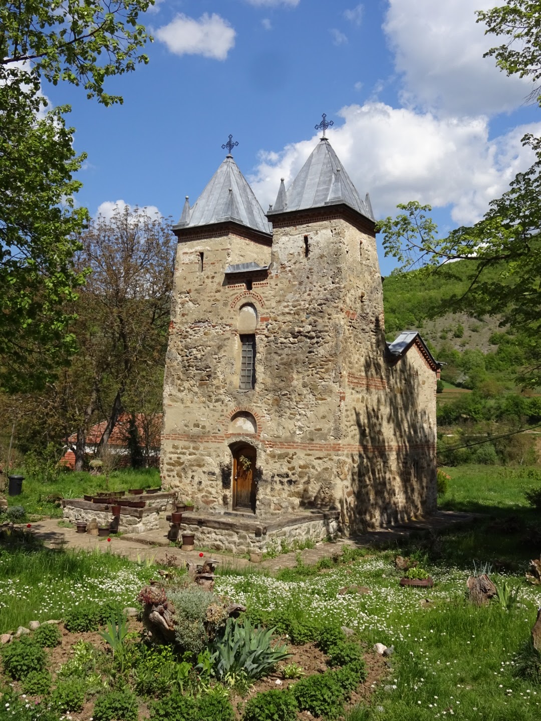
I skirted the edge of the village of Mucibaba then ate my lunch (bought in Knjaževac before I left) in the village of Donja Kamenica. I sat on a bench in front of what may have once been a community hall, now used as a place for sticking up notices of those who had died. This was opposite a 14th century church. I would have liked to have seen the frescos inside referred to in "Rambling through Serbia" but the church was padlocked. There was a Tourist Information office opposite with a promising sign indicating it might sell coffee. Needless to say it was also locked.
After Donja Kamenica it was a track up a wooded valley which would pass close to the summit of the mountain of Cukar. As I neared the top of the trail it became progressively more overgrown until after the farming settlement of Golema Livada. The buildings here looked mostly abandoned. Then a bit of good trail passed the summit of Cukar, before turning off onto an overgrown track. Here I was following a hiking map of the Suva Planina, the corner of which covered the area I was walking through. Finally, a section of good track passed recent wood cutting activity and a goatherd with his white goats who wished to have a conversation in Serbian with me, but was disappointed.
My campsite is a spot high up with a 270 degree view of mountains and a lovely sense of space. The highest mountains in the Stara Planina area to the east still had streaks of snow, now coloured pink by the setting sun.
32.1 kilometres walked today with a 1344 metre ascent. A gpx file of the trail can be downloaded from wikiloc.com, or the route can be found on ViewRanger as johnpon0031.
 |
| Medieval Church of the Holy Mother of God in Donja Kamenica |
 |
| Campsite for the night |
No comments:
Post a Comment